Adelaide

IMG_5278

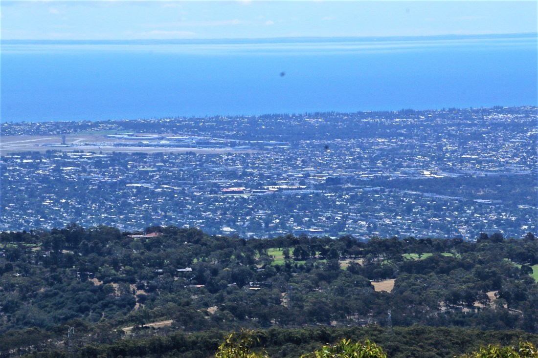
Adelaide from the top of Mount Lofty, so named by Matthew Flinders – presumably, in the opening gambit in Australian humour, because it isn’t . At the time he was circumnavigating Australia in 1802, in the Investigator with his cat Trim.

Flinders had, of course, earlier circumnavigated Van Dieman’s Land with a different cat, one George Bass, in the Norfolk, a boat illegally built on Norfolk Island and hence confiscated when it arrived in Port Jackson, sailed by the naughty but resourceful convicts. Of further note is that Flinders, whilst chewing his fingernails for 6 years under house arrest in Mauritius, came up with the idea of naming as Australia our land girt by sea – oh and the Tasmanian bit too.

Walked most of the way up Mount Lofty which seemed higher the further you went. Nice waterfall at the base in what is for some reason called Waterfall Gully.


There are the remains of a hut beside the track well up in the bush. All that remains are the stone footings. I wondered if it was connected with the rather amazing history of the typically very hard working and successful chinese gold miners in the 1850s, who got sick of being beaten up all the way from Melbourne to Ballarat so they started landing in Adelaide and walking, yes walking, to the diggings – where they got beaten up but at least it wasn’t for the whole trip. It seems no-one knows and the history of the ruins, the owner and the reason for it being called Chinaman’s Hut are still all an unfathomable mystery.   http://www.flinders.edu.au/ehl/fms/archaeology_files/research/HFZCHP/PDF/VoS%20Ch%2014%20Chinamans%20Hut.pdf

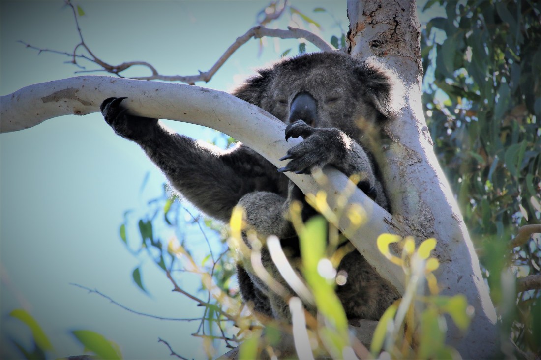
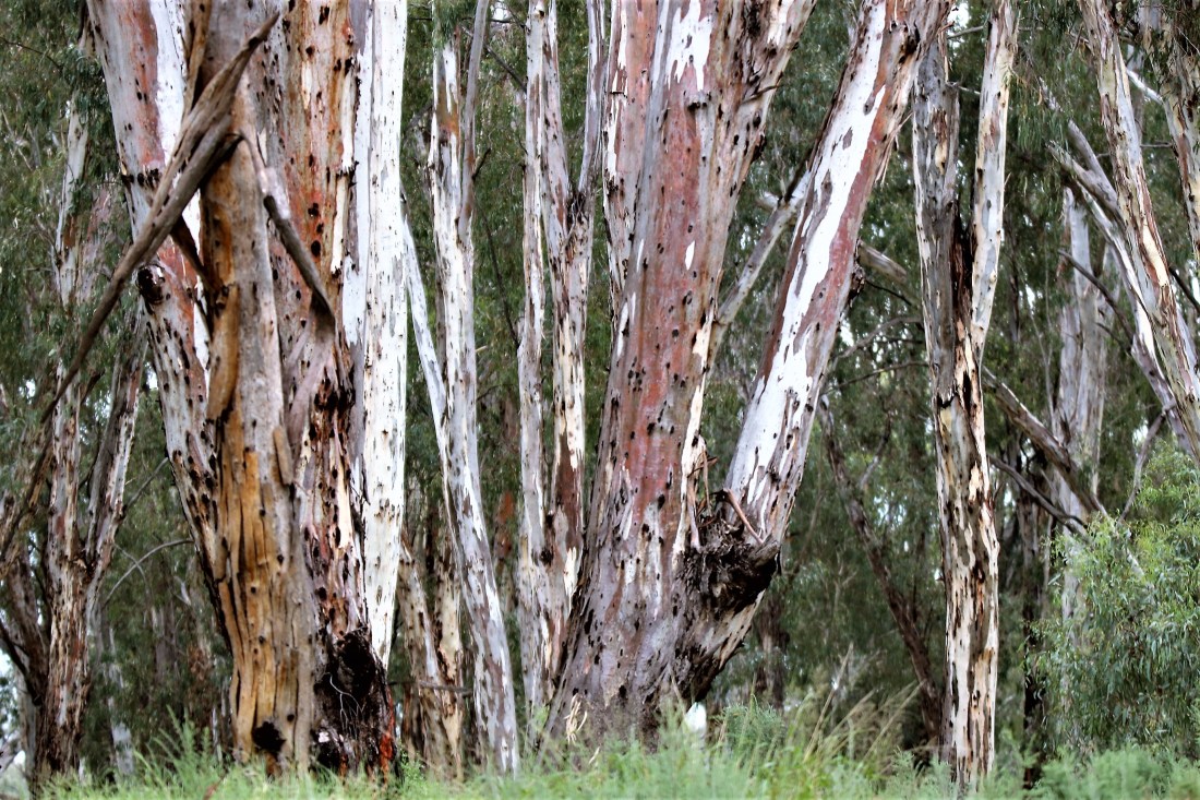
At the top, in a rare event, looking at the koala in the gum tree actually did involve more than an empty gum tree.

IMG_5283

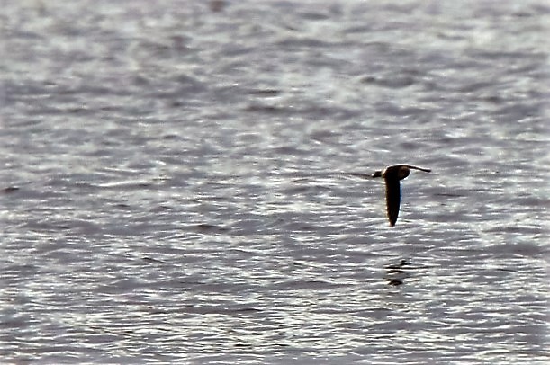
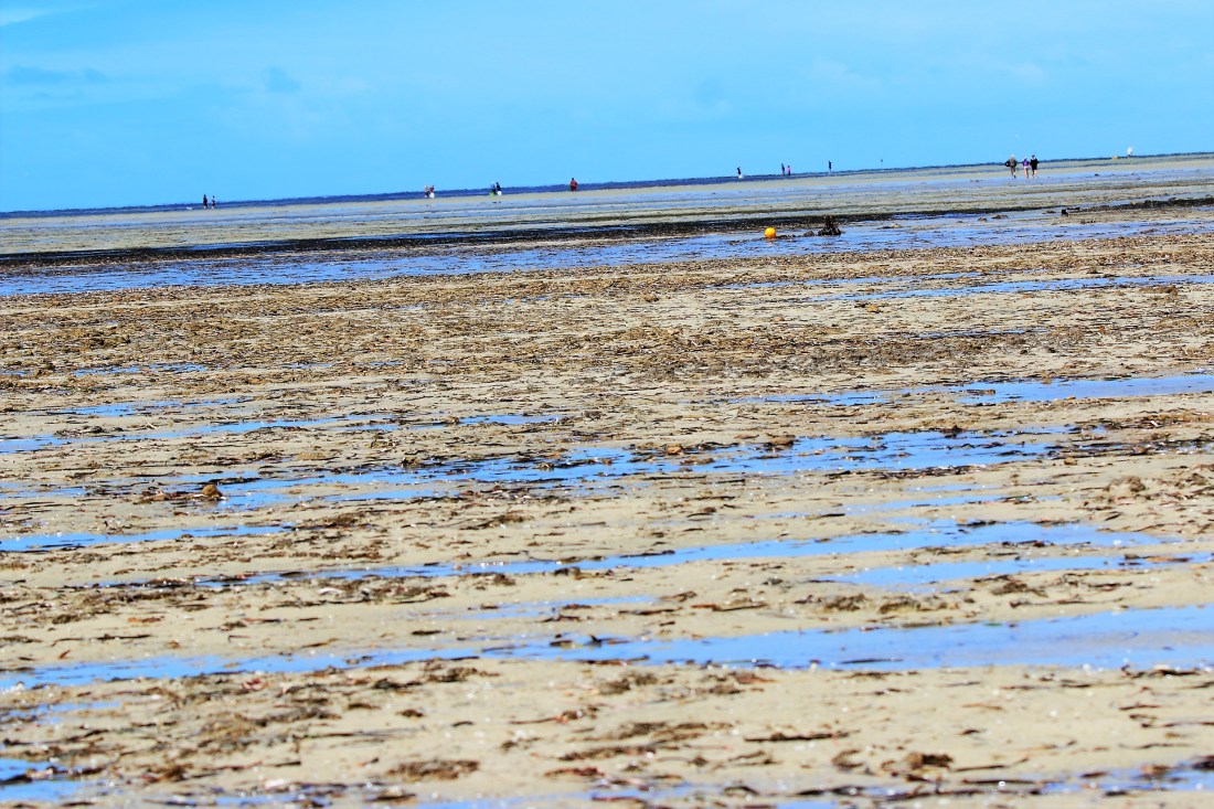
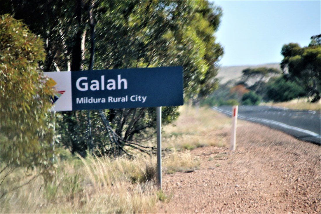
Another trip was up north to the Adelaide International Bird Sanctuary. Eventually discovering it had two gateways we also discovered that, in the spirit of MMMMM, it isn’t really there. It is an area where lots of shorebirds land during migration, just not when we were there. Some nice coastal walks though and the distance the tide goes out rivals the mussel farm areas of Brittany.  People were right out on the horizon, catching crabs, and presumably sporting a handy tidetime app on their mobile device.

IMG_5286

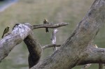
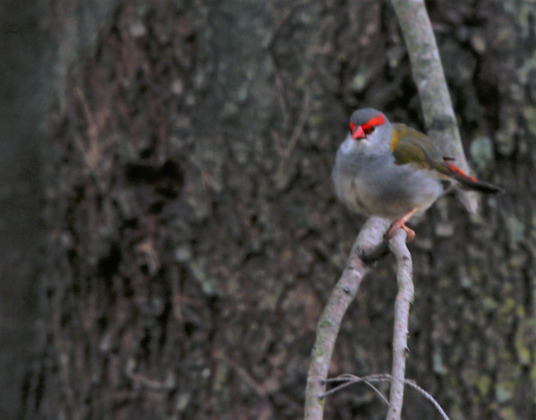
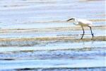
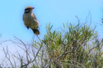
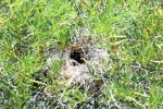
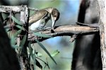
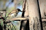
Saw some birds, including a Little Egret (breeding – you can tell by the two long plumes off the back of its head) and a juvenile grey butcher bird, with blood on the top of its bill.  The nest is unusual in that it faces out rather than up.


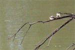
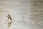
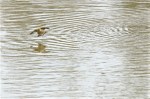
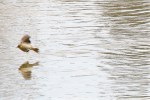
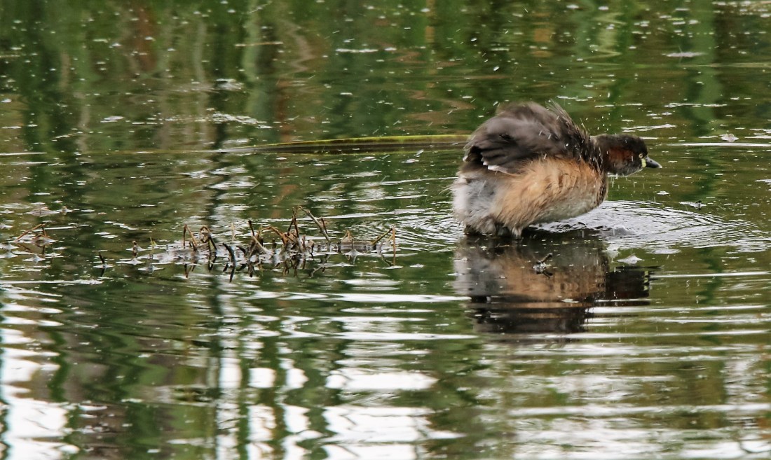
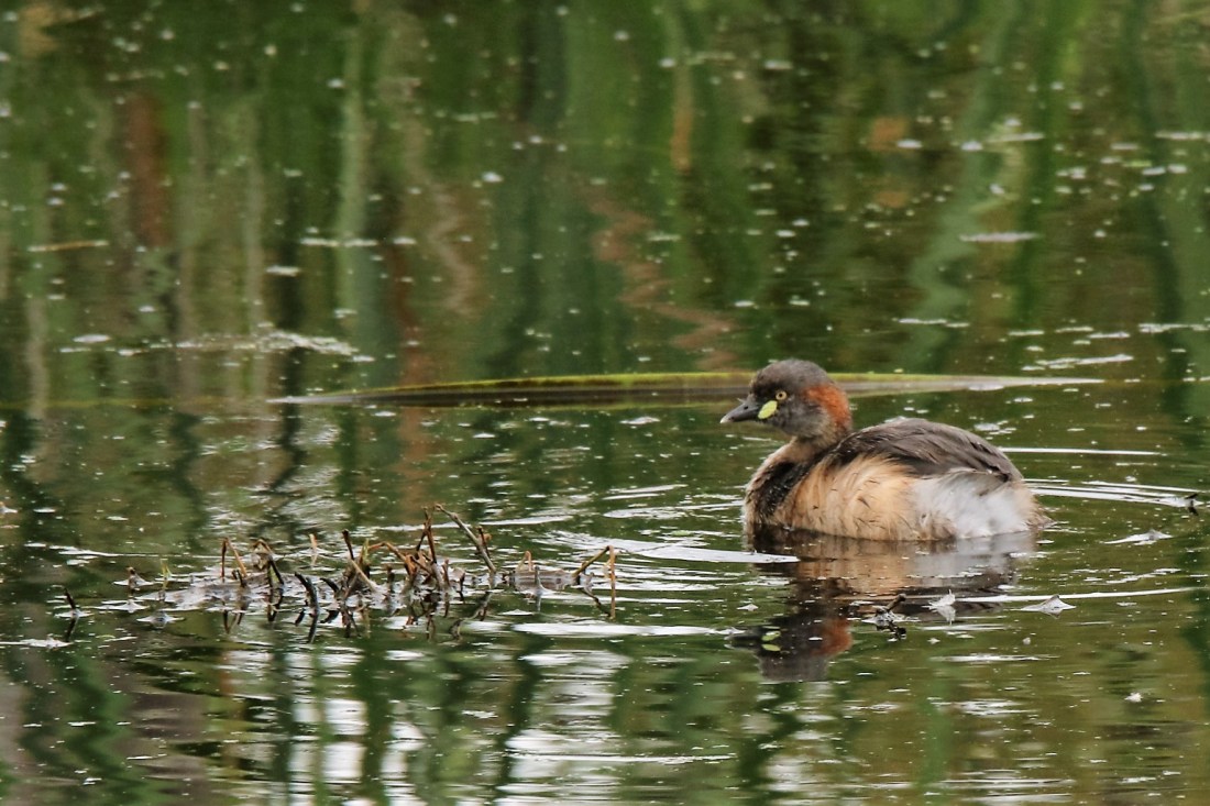
Like Canberra there are many small urban wetlands to manage polluted storm water. At Oaklands, just south of Glenelg, there were the usual lake birds including some Australasian Grebes, the first below being breeding (the nest is suggestive, but the red at the back of the head gives it away) and the second non-breeding.


Michael Monaghan

Balranald to Adelaide via Manangatang and Pinaroo.

IMG_5183

Sometimes you just feel right at home!


Lots of long straight roads on the way from Balranald down through Tooleybuc, across to Manangatang, Ouyen, Murrayville, Pinaroo, Tailem Bend and Murray Bridge.

There are some wonderful fascinating places in Australia, but with respect to Manangatang, it isn’t one of them.


Ouyen had the classic pub, but was accurately described as in the middle of nowhere. Certainly it is a well cared for town, and has a Pickering Street no doubt named after my Perth friends.

The highlight of the trip was the pink lakes north of Linga in the Murray Sunset National Park. Very remote and I didn’t see anyone for three hours. There are some camping grounds which look pretty harsh. The official publications warn you to have plenty of water and that you might not see anyone to help, and I suspect from my experience that that is correct.

The salt is 800 times the concentration of sea water. Thousands of years of moisture then evaporation has left this incredible concentration of pink salt.


The varied scrub forest was attractive to birds especially the parrots. These are my first sighting of Blue Bonnet parrots.

There were also several birds of prey including what I think is an old Brown Falcon.

After the Pink Lakes it was pretty much monotonous flat and straight driving west through Murrayville, Pinaroo, Murray Bridge and into Glenelg.


Around Balranald

IMG_5177
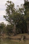
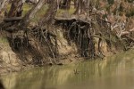
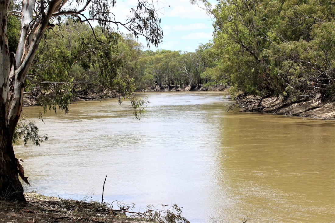
The Murray at Swan Hill.

Balranald is on the Murrumbidgee with four other significant rivers nearby, including the Murray. The Murrumbidgee Murray confluence is just south west of Balranald. Yanga National Park is a new Park created when the NSW Government bought the Yanga property about 12 years ago.

The Woolshed mentioned in Friday’s blog took 3000 sheep and 30 shearers at a time. Further upstream is the well maintained homestead looking out over Yanga Lake.


The Lake is 24 km in circumference and around 5 metres deep. The Balranald Yacht Club have been sailing on it for many years. Before weirs made it more or less permanent, it would fill up Yanga Creek by the Murrumbidgee in flood, and then empty back out the same creek as the river level fell.

Wandering around the edge I spied a juvenile Grey Butcher Bird butchering its breakfast, and managed to catch it as knocked the meal off the branch and dived full speed to retrieve it.

Never having lost my inate skill in picking typos, I wondered if the company that made this huge integrated sign ever got paid.

IMG_5149

Out of nowhere came a flock of Hooded Terns, fishing in the lake.

Overhead a couple of Nankeen Kestrels were out hunting.


Perched high over the lake’s edge this Rainbow Bee-Eater was also flying around in search of, well bees I guess.


From here I drove through the incredibly flat farming land to Swan Hill and then back up along the Murray having a picnic lunch by the Murray in Nyah, then up through Tooleybuc and back to Balranald.

Tomorrow to Adelaide.

Canberra to Balranald

Nothing new to report till after Wagga Wagga. Out across the Hay Plain for the first time in 40 degrees one wondered again at the marvel (lunacy) of the Sturts and Mitchells of the world in their heavy ridiculously inappropriate english clothes, trapsing without offline HEMA maps and google earth to tell them what lay ahead.

Caravan park in Balranald is right on the Murrumbidgee with the classic stands of River Red Gums and thousands of Corellas.  A challenging 43 degrees sees the little pool jam-packed with kiddies, and the Coolibahs jumbucked.

The river is a bit lower than usual at this time of the year, due the camp owner said to the vicissitudes of the many weirs. Still it is a great river with the banks carved metres high by thousands of years of floods – and weir adjustments.


The River Red Gums are majestic. One of the more impressive Eucalypts, although not quite as amazing as the “Heysen” gums of Wilpena Pound.

IMG_4965

I went out to the Yanga Woolshed, built in the late 19th century to cater for 3000 sheep and 30 shearers. The heat must have been astonishing, and unlike at caravan parks, I bet obesity was not evident. All the buildings are still there although unused now for 20 years. It, too, is right on the river. I suppose more than one shearer had a refreshing dip after a day’s hard fleecing, and before a night’s purposeful drinking.


Have seen lots of birds. One I have never seen before is the Striped Honeyeater, right on the southern end of its habitat.

The Peaceful Dove too was right on the southern extremity of its habitat.

IMG_5070 (2)


Perhaps the oddest sighting was of the Yellow Crimson Rosella (platycercus flaveolus), which is literally a crimson rosella which is yellow. It is endemic to the Mallee in quite a limited area.

Last but not least is a huge population of White Plumed Honeyeaters. As the birdbook says, they certainly like a bathe, and as well as being widespread through the red gum forests, are seen dipping into the river and clearly enjoying it.

Was supposed to go on a long 8 hour tour of Sunset in the famous Mungo NP but the rain, although not dramatic, has been enough for the rangers to close the most interesting tracks (the china wall) so it has been cancelled.

More from around here tomorrow.


Michael Monaghan

Rare sightings at the Jerrabomberra Wetlands.

At the Wetlands today, on an overcast cool day, there was a range of birds I have never seen there before plus some hard to spot little fellas.

The winner is a rare shot of a Nankeen Night Heron which got flushed out of hiding by the amorous activities of the Purple Swamphens. I never would have seen it otherwise, as they sit so still for hours on end. Got a couple of good shots before it moved just a fraction further in and became again invisible. I have seen one before there a couple of years ago.

Out of the corner of my eye I spotted a very small something high on a branch. It turned out to be a European GoldFinch, which I have never seen anywhere before.

It is easy to dismiss the ducks as just ‘the ducks’, but there are so many different ones. It was the first time I had spotted the Freckled Duck.

An unusually coloured grebe I later identified as a breeding Australasian Grebe. The bright attractive yellow cheek spot is the giveaway.

IMG_4919

IMG_4922

Hard to photo little fellas include in order: welcome swallow; white-browed scrubwren; yellow thornbill; and red-browed finch.

IMG_4893

IMG_4932

IMG_4931

A great spot, and with a bit of patience there is always lots happening.


Par Avion to far south west Tasmania.

IMG_0176

Last October, on a rare clear calm day which I had carefully picked out of the weather forecasts, I took a Par Avion trip from Cambridge airport, near Hobart, to Melaleuca, south of Port Davey in the far south west of Tasmania. It was sensational and made more memorable because of the connection to my mother’s family – more of that later.

We flew out along the Derwent south over the Huon River, to the D’Entrecasteaux Channel.  There the scale of the salmon farms was evident. The big pest are the seals (although some say the salmon), which show incredible ingenuity to get into the pens for the easy pickings. The farmers catch them, truck them to the seas off the far north-west of Tasmania, where they gratefully indulge in “relationships” with the females, and then are back in the pens even before the trucks get back.

Rounding over Cockle Bay, there came the incredibly spectacular south coast.

The South Cape Rivulet, stained with timber oils, was where one of the few people to venture into this country (Charles King, father of the famous Deny King) started mining tin in the early 1900s. The rivulet still carries the rail-line he built to get the tin out.

Flying into the “settlement” of Melaleuca, you see part of the 7 day track, with the occasional boardwalk sections. The massive and relatively shallow (average depth just 7 metres) Bathurst Harbour opens out to the north. I only just discovered through map staring , that the south-west of Tasmania is actually an island, cut off by the Melaleuca lagoon and creeks.

The MIA (Melaleuca International Airport) is a thriving hub where apparently you can’t land more often than you can land. There is a lockup shipping container as the terminal storage and, well a largely destroyed wind sock. The only building is a substantial hut built by Denny King, and a couple of stand alone bedrooms on blocks to keep the kids safe from the snakes.


With water water everywhere, although generally salty, there are lots of wildflowers and birds. The small bird with the yellow throat is a Yellow-throated honeyeater, unique to Tasmania. The other is the New Holland honeyeater.

There are some interesting walks, and a boat trip up moth creek into Bathurst Harbour. Although a safe harbour away from the southerlies, it is also shallow and the open water can be very wild for small craft. We were lucky to cover a larger territory than is often possible.

We were very fortunate with the beautiful calm day so were able to take off and head further west out over Port Davey (well below the more accessible Strahan and Macquarie Harbour), then head back over Federation Peak and the Hartz mountains.

The final stretch is over the upper Huon, much of which was explored and cleared by my Great great great grandfather, William Fletcher,  Great great grandfather, Charlie Fletcher, and Great grandfather, Frederick Fletcher. There is an interesting link to Deny King and his family. Deny’s father had bought some land in the outblocks of the Huon Valley. “The only human habitation beyond that was the cabin of lone prospector, Charlie Fletcher, eight kilometers further out.” (King of the Wilderness. The Life of Deny King. by Christobel Mattingley p9). Apparently Charlie was a kindly chap who helped the King’s with their buildings and took them (even further) out teaching them practical bushcraft.

Out back of Judbury, ie anywhere, you can find Fletcher’s Hill and Fletcher’s Lane.

And to cap it off, I got a glimpse heading back into the airport of the area south of Rokeby, on Droughty Point Road and Clarence Rivulet, granted in around 1808 to my first fleet ancestors.

IMG_0343

A fantastic trip I would recommend very highly indeed.

Mt Lyell Railway, Western Tasmania.

Earlier this year I took the Strahan – Dubbil Barril – Strahan western rail trip. It was up there with the best trips I have ever had. Luckily it was also a bit wet, which definitely added to the richness of the forest.  Next trip I will definitely do the other half, the Queenstown to Dubbil-Barril leg.

The story of the railway is astonishing.  It really shouldn’t have been possible.

Take yourself back to 1893. Tin, silver, iron ore, osmiridium and lead had been already extensively mined around Mt Lyell and Zeehan. Some small, but rich, gold deposits had also been found in the area in 1883. But by 1891, two “outlanders” bought into the Mt Lyell gold mining company, not because they thought there was gold in them there hills, but because they knew a gold mine of copper when they saw it; and Mt Lyell was definitely one of them. William Orr (sic) brought out another American, Robert Sticht, who was a brilliant metallurgist. Together they developed cutting edge copper mining processes, and set about working out how to get the copper to the harbour at Strahan.

Several surveyors correctly told Orr that it would be impossible. And then the third lot realised that ‘not possible’ was in fact not the correct answer, and said it was indeed possible. If you look at it, it isn’t possible – but yet they built it. Over 5oo men worked on the job, working and sleeping without cover in the almost perpetual rainfall. All the rockwork had to be done by hand because it is slate, and explosions could bring whole hills down.

Building the railway through the densest rainforest you could imagine, and with a raging King River right beside them, is an astonishing feat.  The track and most bridges have been restored – an inspired decision indeed.


No-one working on it had ever even seen a rail locomotive. They got the train in a flatpak, without instructions. Working off the picture on the box they successfully put it together.


When the owner had them put in the rack and pinions (abt rack technology) on the steepest bits, they were even more convinced he was mad.

IMG_1486

The only original bridge is the one underneath. That is another astonishing story. Again, the bridge arrived in a flatpak. They put it together seated on a duplicate rail line. Then they got a raft and stacked it with timbers till it was the height from the river to the bottom of the bridge. They then SO SO SLOWLY pushed the bridge out onto the timber support. A couple of likely lads with ropes tied to the barge were on the far bank. Ever SO SLOWLY they pushed the bridge and pulled on the barge to manoeuvre the bridge across the river. The chances of them needing another one was very high, but again the impossible was achieved.

The King River has thoughtfully maintained the remnants of one of other early bridges in sight to mock the foolhardy who think they can conquer it.

IMG_1424

Then there is the scenery. Astonishing.

Last, but by no means least, is the trip itself. Make sure you pay the extra for the Wilderness Carriage. Apart from some excellent snacks, and a chocolate locomotive, there is a very knowledgeable guide (who also knows a lot about the technicalities of the mining and recuperation of the river), but best of all is that the carriage is at the back going up, with a small outside balcony – fantastic for the photographer but also just to get a better view of the track, bridges and environment.

See for more information:

http://www.wcwr.com.au

Click to access HRP.West%20coast%20Wilderness%20Railway.Tasmania.Nomination%20Volume%201.V7.August%202015.pdf

http://www.queenstowntasmania.com/Mt_Lyell_Page.php