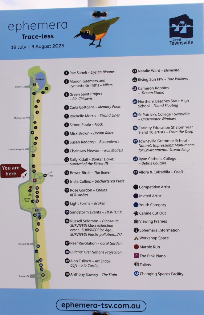
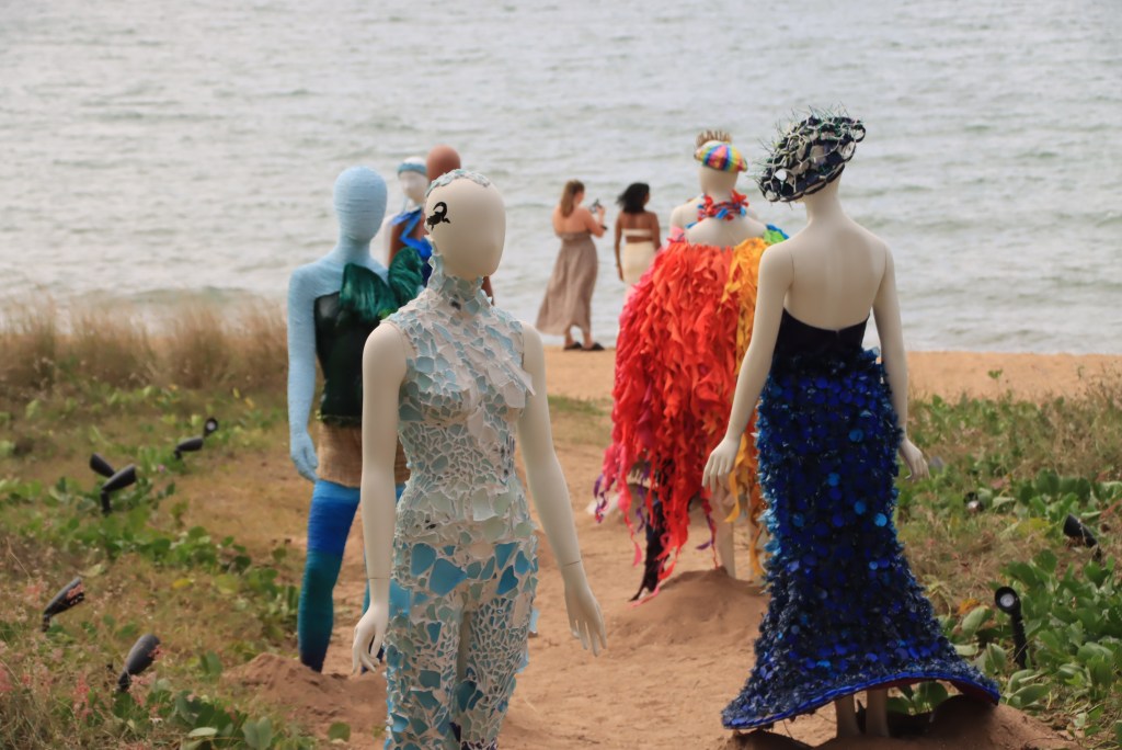
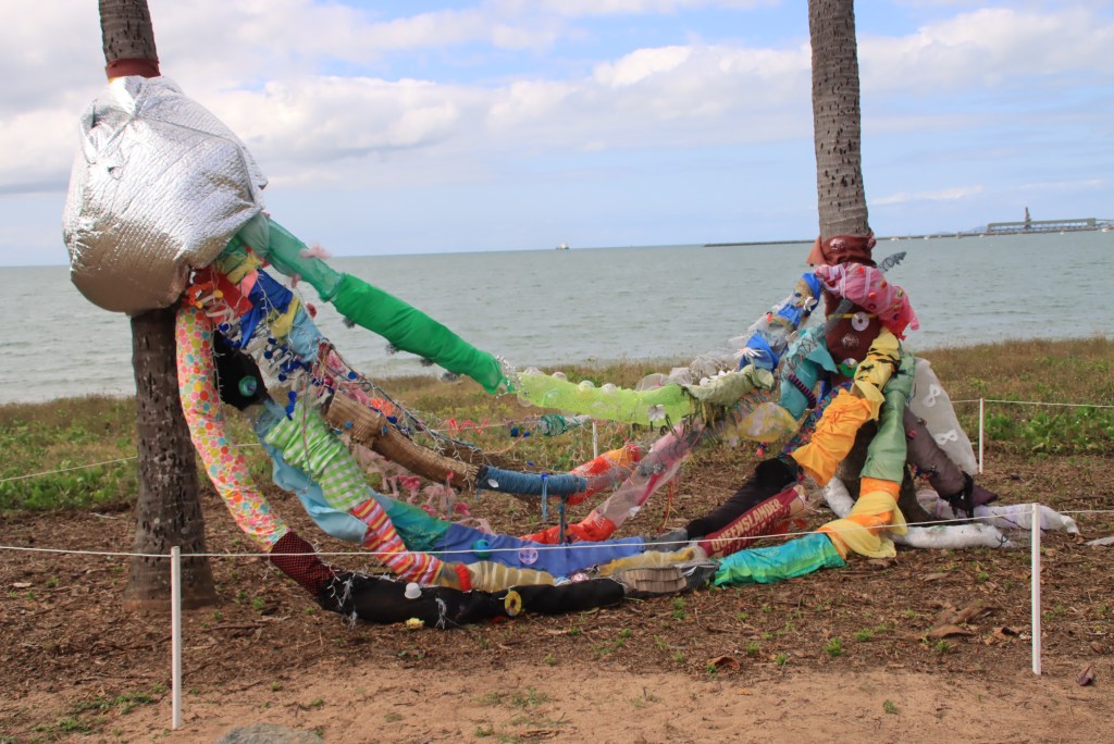
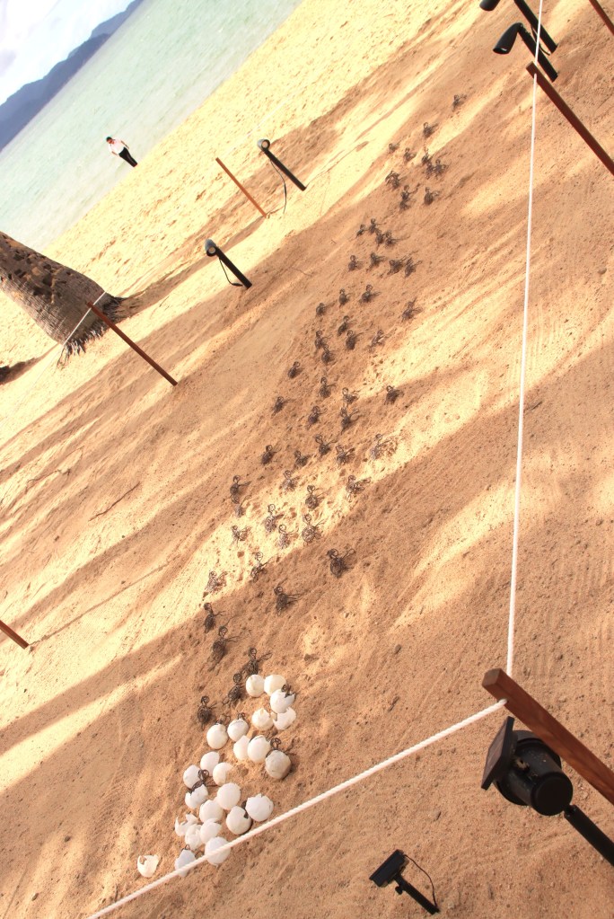
Townsville Qld , each year in July, presents an avenue of Ephemera – not necessarily ephemeral in themselves, but ephemeral in their presence on The Strand, a set of pathways running along the waterfront.
This is them:


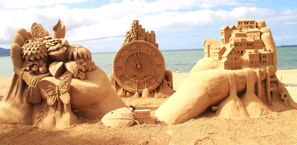


MICHAEL MONAGHAN
July 2025
Townsville Qld , each year in July, presents an avenue of Ephemera – not necessarily ephemeral in themselves, but ephemeral in their presence on The Strand, a set of pathways running along the waterfront.
This is them:
MICHAEL MONAGHAN
July 2025
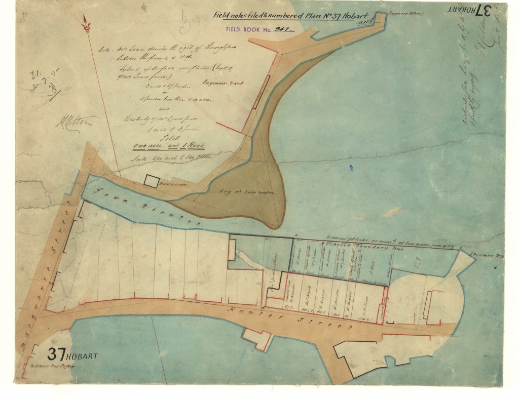
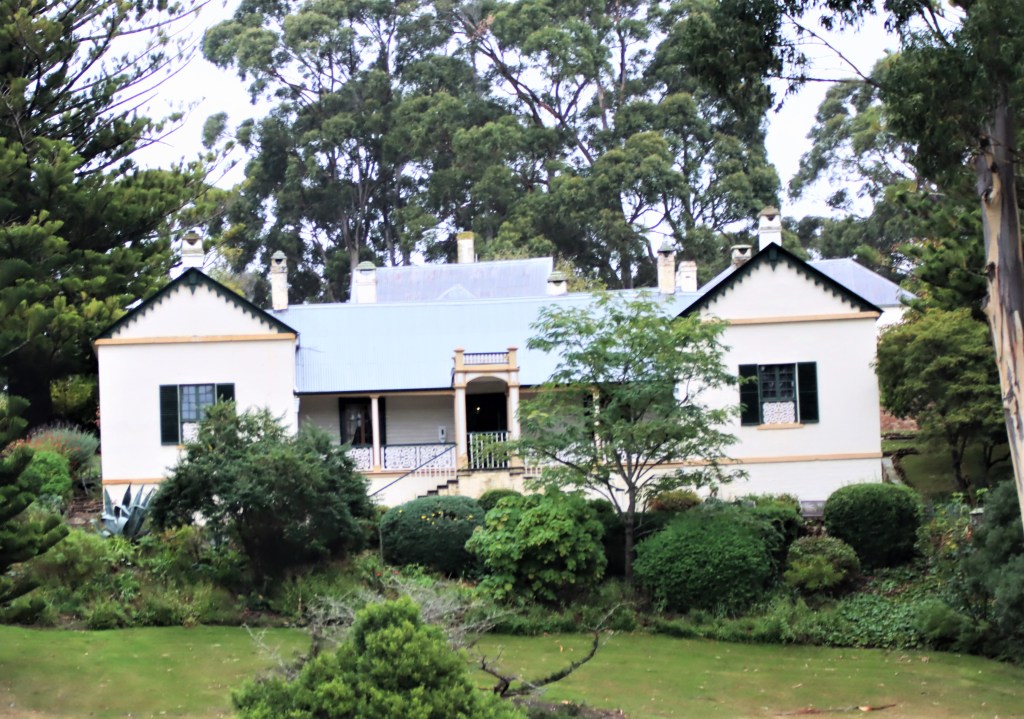
One of the properties open as part of the OpenHouseHobart weekend was Roslyn Estate. This is at the northern end of White Kangaroo Road, off Fingerpost Road, in Campania.
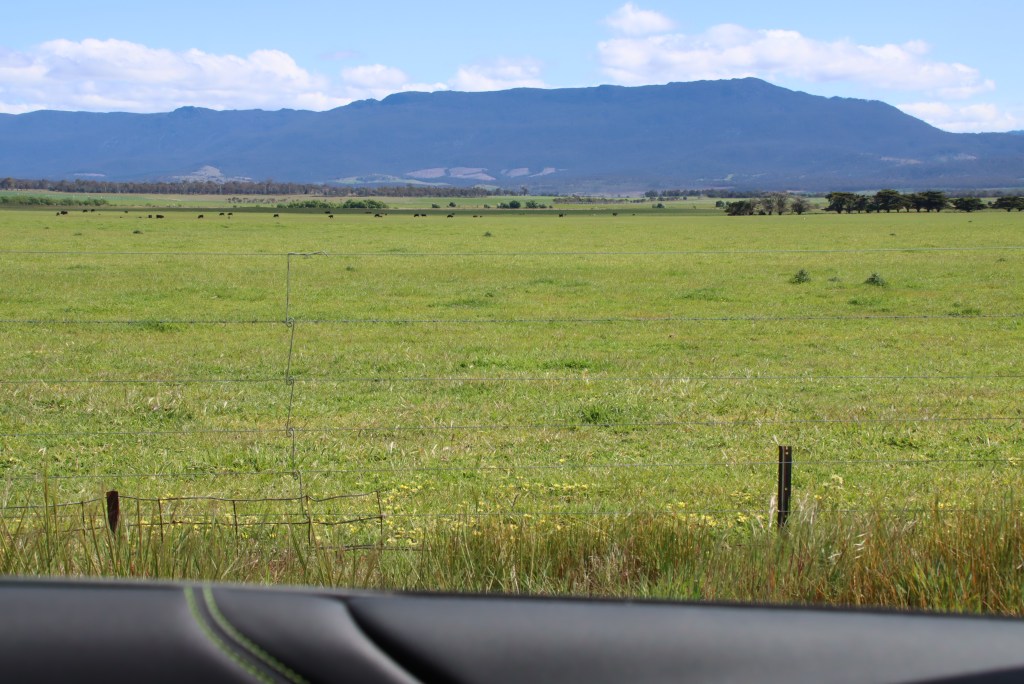
This is now a vineyard, like almost every inch of land in the Coal Valley. The recent vine plantings down this way are beyond astonishing.
We had first visited an 1850s schoolhouse in Dulcot, just south of Richmond, which was part of a State wide exercise which saw prefab schoolhouses placed in many places across the State to give the farm children some formal education. Noel Frankham, whose family include Belbins, Hanslows and Murdochs (not those ones), has turned the Dulcot one into a sensational house with a deck and views to die for.
As if that wasn’t enough, he has recently had moved a 5 room family house, which used to be down on the flats below Dulcot, in 4 pieces up to what may well be called, Upper Dulcot. Also moved were a number of sheds. All these were part of his family’s houses in the 19th Century. As is inevitable, I recently discovered I am (indirectly through the Belbin line) related to Noel’s family.
In a bizarre twist of the planning laws, the new place can be used as an Airbnb, but not for permanent accommodation. Just as well this isn’t a shortage of that.
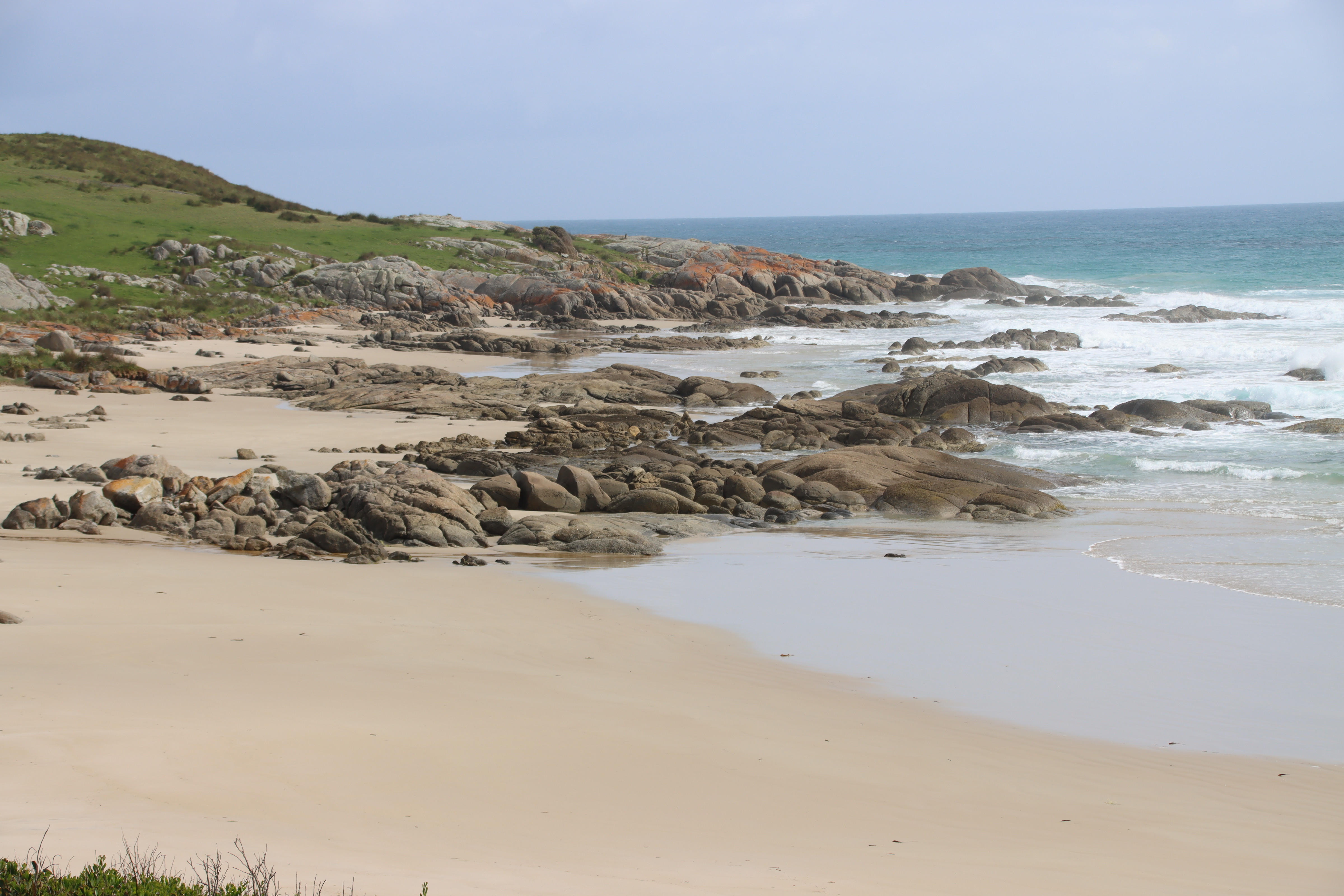
Next, after a scallop pie in Richmond ( in my view the third best in the State after Exeter – the leader by a mile/1.6 kms – and Ross; I might add that Deloraine Cafe and Bakery was rated minus 1 out of 10 – the curry sauce was ok, but I struggled to find one whole scallop), now where was I , oh yes, we went out to White Kangaroo Road.
I recently discovered, about this time last year, that one of my mum’s direct ancestral lines was to the Hobbs family. She never knew about that. The Hobbs family, headed by the widow, Anne Jane, came out sponsored by my gggggrandfather, William Hopley (husband of Judith Hobbs and father of Julia) on the Calcutta with David Collins. Collins, fairly half heartedly, tried to establish a settlement at Sorrento, in Port Phillip Bay, but with relief, was granted permission to move to the Derwent River. Anyway, as anticipated and indeed expected, the Hobbs girls married the free men on the same ship, as best it could be managed. One of the Hobbs daughers, Jane Anne, married the surveyor, George Prideaux Harris.
Keep with me here.
Harris and Jane had one daughter Eliza. They, by current accounts, had another, Melvina, born after Harris died.
Enter one George Weston Gunning. He arrived in Hobart in 1810, a lieutenant in the 73rd regiment (Lachlan Macquarie’s regiment). He was clearly a favoured son, being sent to restore order in VDL, and being granted land on what is now the Hobart waterfront. His neighbour, I find, was G P Harris and his wife, Anne Jane. Hold that thought.
In 1810, Harris was ill and dying. He died in October 1810. Melvina Harris was born in mid May 1811, and was said to be the posthumous daughter of George Harris. There are some published letters back from Anne Jane to Harris’ mother, some many months later, which seek to comfort her with that information. My direct ancestor, William Hopley, wrote that Anne Jane was pregnant at the time of George’s death.
After Harris’ death, Melvina and Eliza were granted land along White Kangaroo Road, essentially adjacent to George Weston Gunning’s massive land holdings. In 1828, a Moina Gunning died aged 16, the only daughter of Gunning. I have found that in 1828, the same block of land owned by Melvina Harris, became identified as owned by Moina Gunning.
To cut a long story short, there is no doubt in my mind, that Moina and Melvina were the same person, so Moina/Melvina was Gunning’s daughter to Anne Jane Harris, conceived before George died. Certainly by 1812 and 1815, records exist saying Jane Harris was living with Gunning.
Anyhow, this is where the story really starts:
Eliza Harris married George Burn. He had, and continued to have, large blocks above Hamilton, up the Shannon River. As a wedding present, George Weston Gunning gave George and Eliza (Gunning’s step daughter) the property which is Roslyn. Eliza’s original grant south of Roslyn and thus also south of Melvina/Moina’s, is still there as Eliza Farm.
So serendipitously, I was in the region when Roslyn was open to view.
The owner was a fantastic hostess and tour guide. One matter of history I could help with was whether the property known as Campania House, visible from Roslyn, was built in Gunning’s time. I was able to contribute from my research that it was not, but was built by the purchaser of the property from Gunning. Contemporary travel diaries confirm Gunning’s was a small house, called Weston Villa, not the Campania House mansion of today. Gunning in fact went totally off the rails when his daughter died, and the property fell into ruin. I was able to add a fair bit about the region, the families and the properties from my research, which people seemed to find added value.

Roslyn house was originally built in 1823. You can see from the back walls that there were two buildings, one for the family and one for the servants The middle was open, which is evident from the internal walls having windows. Although all the bricks were made across the road (as were all the bricks for early Richmond), there are slight colour differences where the external courtyard was filled in.


The original bell remains, used to call workers in for lunch or to warn of bushrangers. (An interesting aside, David Collins inadvertently created the bushranger problem. When he was swamped by 600 Norfolk Islanders, he had no way to feed them all. So he told them, if they wanted, to head out and range the bush for food. So many did, becoming less hungry the more guns they obtained.)

An interesting feature of the house is that the front entrance is grand and designed to impress. The main part of the house is realistically practical.
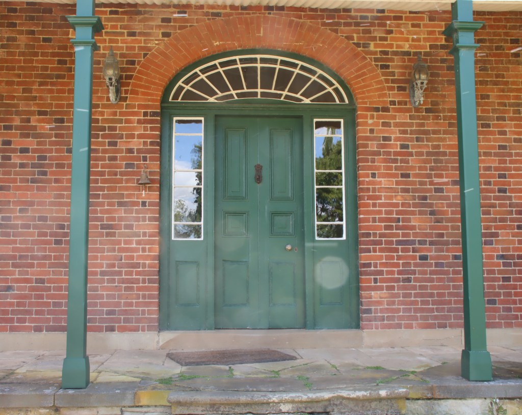
The doors at this end are a good 6 foot high and made of attractive timber. But this is only so for two front rooms. The door jamb from the formal rooms has a slope down, so it hides the fact that all the doors inside that point are significantly lower. Hard to see in the photo but the top of the door jamb slopes significantly down to the further side.
The wine cellar was original. Over $100,000 had been spent by the current owners to ensure water didn’t run into the cellar. Makes you realise the value of the free convict labour.

The original stonework is in remarkably good condition except for a couple of treachorously worn stepping stones.

A very interesting tour, with the only resentful attendee the possum rudely woken from a comfortable sleep in the barn.

Michael Monaghan
November 2024
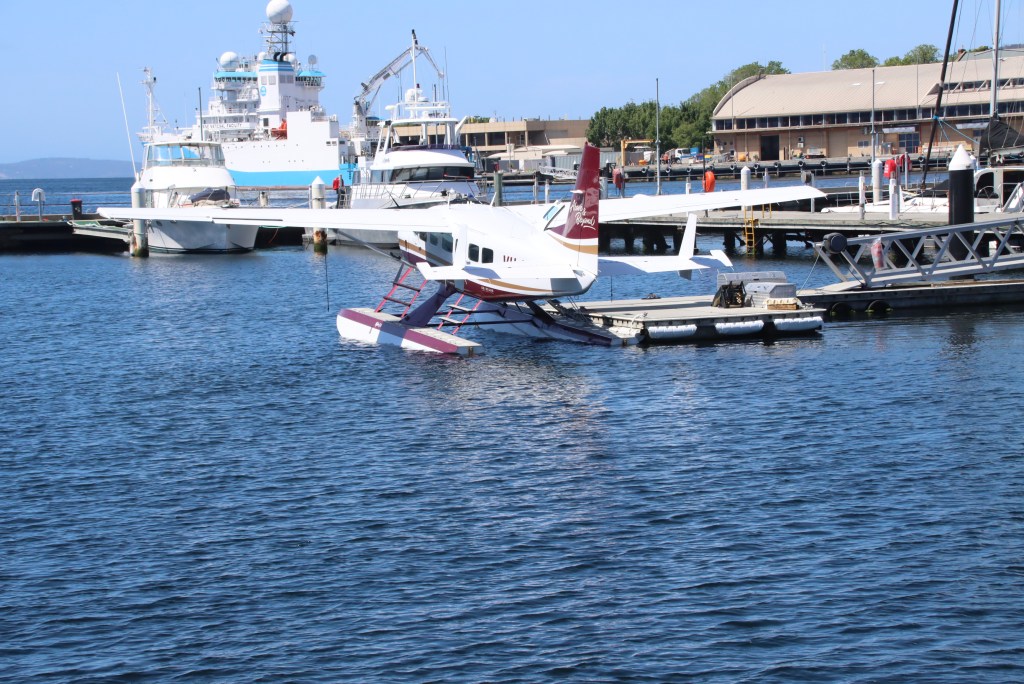
Just a cameo post of the variety of vessels docked in Hobart today. At 18:31, there was one less, with the Carnival Splendor heading for more no doubt fleeting visits.
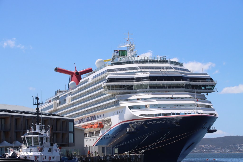
This ship was headed for Port Headland, where, my trusty Marine Traffic app tells me, it will arrive on November 20. No doubt because of excellent maintenance facilities, rather than for tax purposes, it is registered in Panama. It was built in 2008, and has an average speed of 12knots, but a maximum of 22knots.
It left Hobart, as the app predicted, dead on 18:31. I happened to wander past a few hours prior to that, to see passengers heading home, generally with Salamanca Place looking bags.
As always, quite a variety of other craft:


Michael Monaghan
November 2024

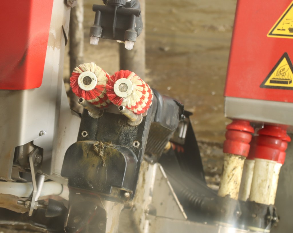
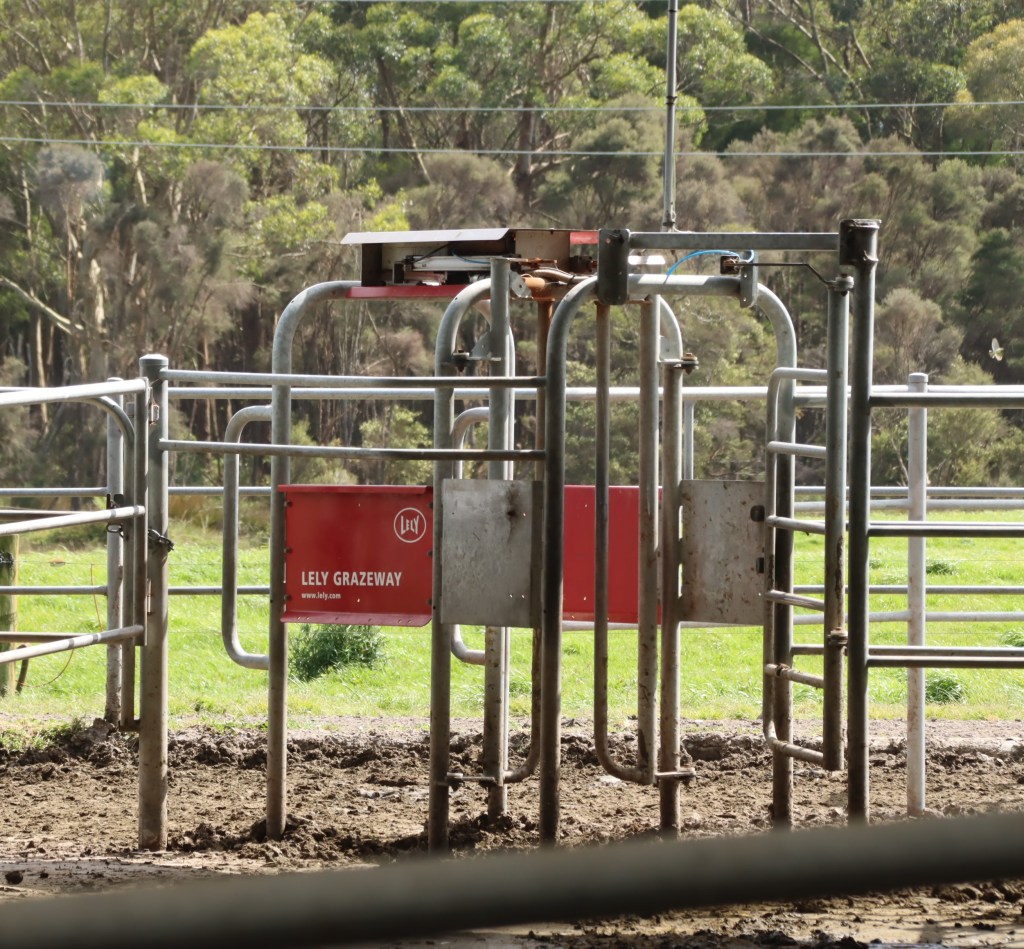
At Smithton, did a tour of the Duck River Dairy. A few years ago I toured, with my Uncle Tony, what was then one of the most technologically advanced dairies in the world. The cows were all micro-chipped (I assume with the same technology that saw all humans in the world chipped with the covid vaccine that every nation on earth collaborated on). They came in to feed when they wanted to, and were milked by robotic machines whilst they ate. Very calm process. “Happy cows make great cheese”.
Now it seems this has become a mainstream process. The Duck River Dairy in Smithton, NW Tas, only has two robotic milkers. Each one though, costing $300,000, milks about 60 cows a day. Each cow gets milked, on average, 2.8 times a day. The machines pay for themselves in saved labour costs (and not having to get up at 4am) in a few months. Each cow gives about 14 kg of milk per day.
The robot cleans the teats, measures out the correct feed, applies the teats tailored to each cow, provides a back scrub if wanted, and sends the cow out to the appropriate field – for example, to the medi-pen if it thinks they are crook.
Milk that the robot thinks is diseased or iffy gets dumped.
The robot identifies illnesses in the cow, problems with the milk, issues with feeding etc etc. Warnings go to the farmer via his mobile, so he doesn’t even have to leave the pub.


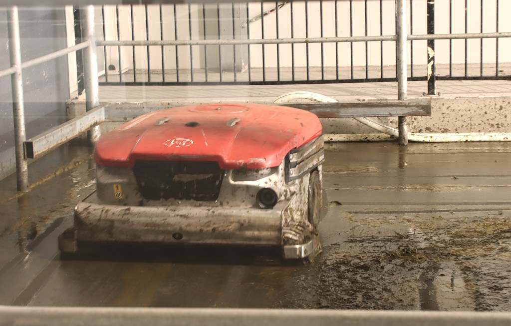
A robotic vacuum, costing $40,000, works 24/7 sucking up cow shit. This is remotely pumped out to holding stations, and then used to fertilize the paddocks. The cows hate it; similar I guess to elephants, they don’t like little critters roaming about their feet.
North west tasmania is the richest dairy country in the State, and indeed amongst the richest in the world. Apparently 95% of Tasmanian milk is exported.
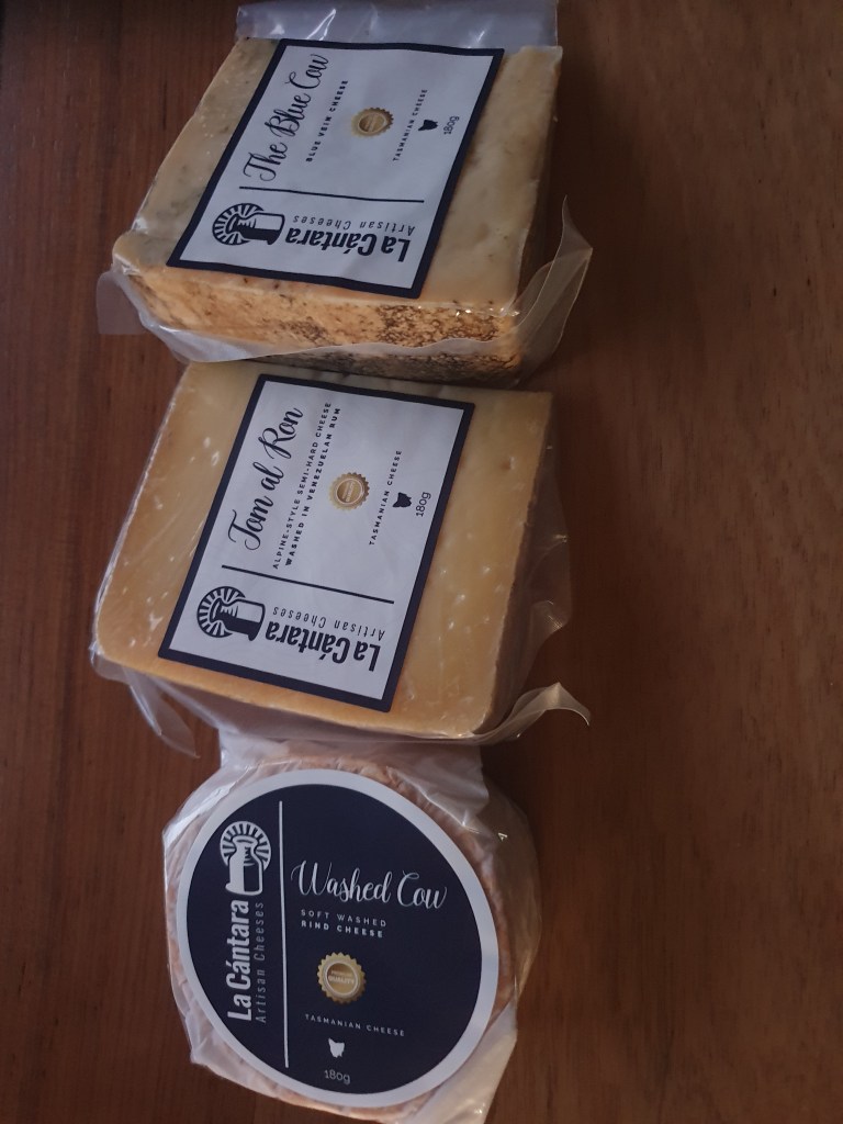
The main game for the Duck River Dairy is cheese. La Cantara is the cheese company run by a Venezuelan who has introduced Venezuelan techniques into his cheeses.
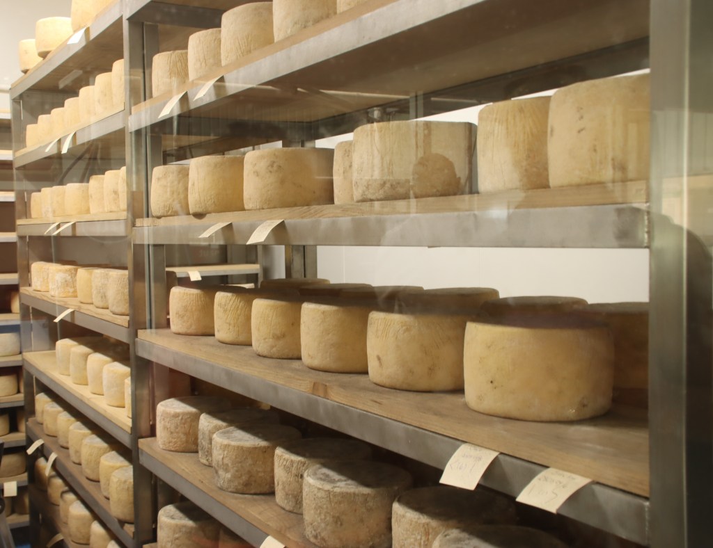
For example, the smoked cheddar is smoked by rubbing smoked paprika into the cheese. There is a Venezuelan equivalent of haloumi. The blue vein cheese is very delicate and smooth, with the bite of the blue very subtle.
There is a cheese link to the Carroll family, part of my first fleet family through marriage of Thomas Carroll to my first fleeters’ granddaughter, Mary Anne Goodwin/Briscoe. Carrolls also feature in the Joe Lyon cottage.
My first fleet ancestors, married in 1790 in Port Jackson, are Andrew Goodwin and Lydia Munro. Mary Anne is the first daughter of Andrew and Lydia’s second daughter, Sarah. Benjamin Briscoe, her first husband, drowned when Allender’s ferry went down off today’s Bellerive. Sarah is of note in that she successfully fought for the re-grant of the land she owned with Briscoe, on the basis that Macquarie had granted it not to Benjamin, which would be the most common process, but to both Benjamin and her.
Mary Anne’s “married” lives would fill a book, with marriages, de factoes, bigamy, false name marriages – she finally died “..one of the most respected and noblest of women”.

Next visit was, in Stanley, the childhood home of Joseph Lyons. Lyons was the 10th Prime Minister of Australia. He is a bit distantly related to me via the marriage of Mary Anne Briscoe to Thomas Carroll. Although he lived his married life in Home Hill in Devonport, this cottage is where he grew up.

A very interesting fact about the Nut at Stanley is that what is there is what is left, not what was there. There used to be a volcano there. Millions of years saw the inner base of the volcano solidify with rain, mud, animals of misfortune etc. Over time, the volcanic cone has eroded away to nothing. So the Nut that is there is the inner base of the volcano.

Thursday saw us on an all day tour of the magnificent Tarkine, with tour guide Robert Saltmarsh. Not only was he the star guide of the Back Roads episode on the Tarkine, hosted by the actress Marta Dusseldorp (star of Bay of Fires and Jack Irish), but his paternal ancestor, William Saltmarsh, was first fleet, Port Jackson, and Norfolk Island, with my first fleet ancestors.
I had been to some of the places we went before, but this tour certainly added massively to my knowledge and understanding. Trowutta Arch via some backroads was the first stop. The morning sun gave a different look to the last time I saw it.

The rainforest is certainly spectacular.


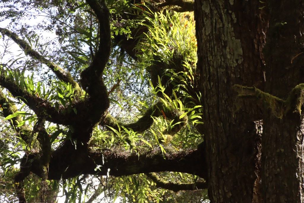

Rob pointed out the quite stark line between one of the great cold climate rainforests of the world and the neighbouring old growth forest, which itself was largely devoid of eucalypts, featuring rather sassafrass, celery top, myrtle, blackwood and leatherwood.
Blue Gums are now mass grown in plantations for the pulp mills. They are allowed to grow for 25 years, several hundred years short of a natural lifetime, then harvested, and another bluegum crop planted. Many hundreds of trees looked dead in this area.
We moved on to an area where the Bob Brown organisation fought to stop the extension of the road to allow more destruction of 300 plus old growth forest. Not publicly known, it was sensational forest. I wondered how any human could bring themselves to destroy it. Even the yabbies liked it:
There were some great opportunities to quickly focus, from bridges, on the Arthur River

and the Frankland

hoping against the contemporaneous presence of a log truck.
The Sumac lookout features the rainforest and the old growth forest,

Next we headed out through the button grass and heath plains to the Edge of the World, just south of the mouth of the Arthur River. Given the logging which goes on up the river, the coastline is perpetually littered with millions of logs.

The Edge of the World is possibly the western most point of Tasmania. Or this might be West Point, or not. Or it might be Cape Grim or not. But the Edge of the World steals the march, like the better resourced of the many “unique” equator crossings you find within a few kilometres of each other. Maybe just because it has the best lookout structure and lunch pavilion.


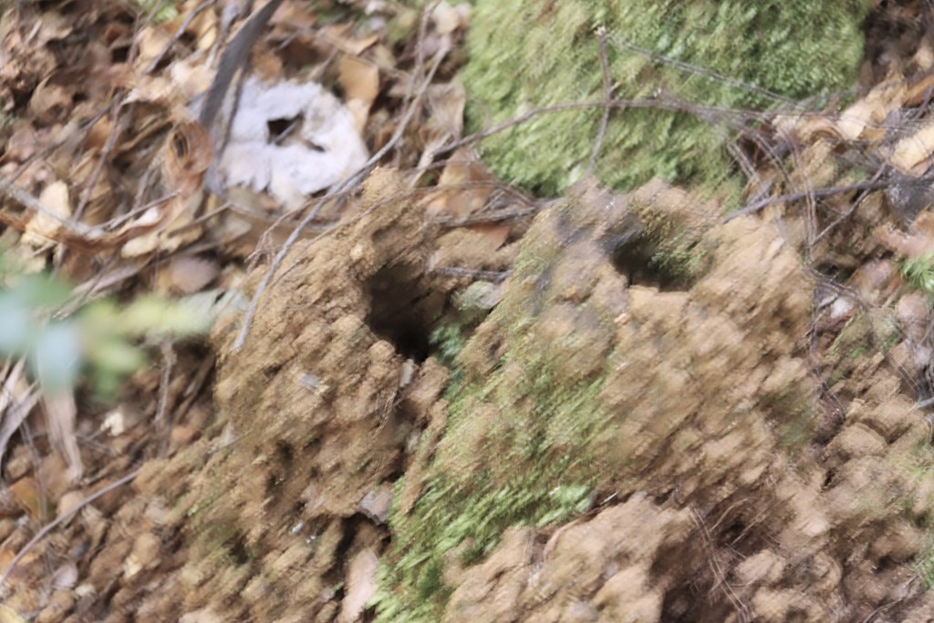
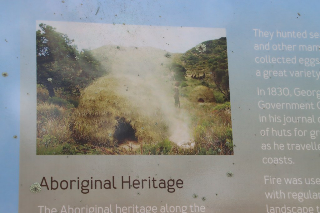
West Point has extensive sand hills around the bay’s edge, littered with billions of shells – the remnants of millions of meals over millenia. Also there are the cup shaped foundations of huts of varying sizes. Archaelogical expertise says the huts were built, maintained and occupied over at least five thousand years.

With a final view of Cape Grim in the distance (named by Flinders because he thought it looked like a man with an angry face), we headed back.
Michael Monaghan
November 2024

After a much friendlier windscreen notation from the bio-security chap than the usual tick, Geelong to Devonport proved another fairly smooth ferry ride, much smoother than the construction of the new ferries.
I made my usual start with breakfast at the wonderful Christmas Hills Raspberry Farm. Their ongoing success was evidenced by the major extensions underway of their vine areas, and the re-development of the walkway around their little lake.
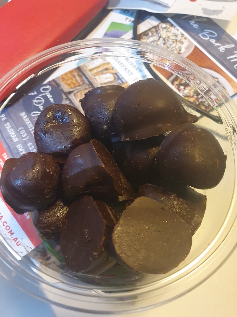
Is a chocolate coated raspberry ok at breakfast time – yup.
Coming down some previously unventured backroads from Deloraine through Cressy, and out west and back into Campbell Town, it was very apparent why the English pastoralists’ eyes lit up at what they saw.

Apart from the compulsory unnecessary book acquisition at the always exciting Book Cellar, this time a new copy of the valuable research tool, Bateson’s Convict Ships, my only research success was to find a previously unseen earlier anglican cemetery than the one at the church. Am looking forward to getting the Hobart Archives, to see if there are any records, as I try to find the burial of my great, great, great, great grandmother, a notoriously difficult lady by all accounts, accidentally killed by her husband.

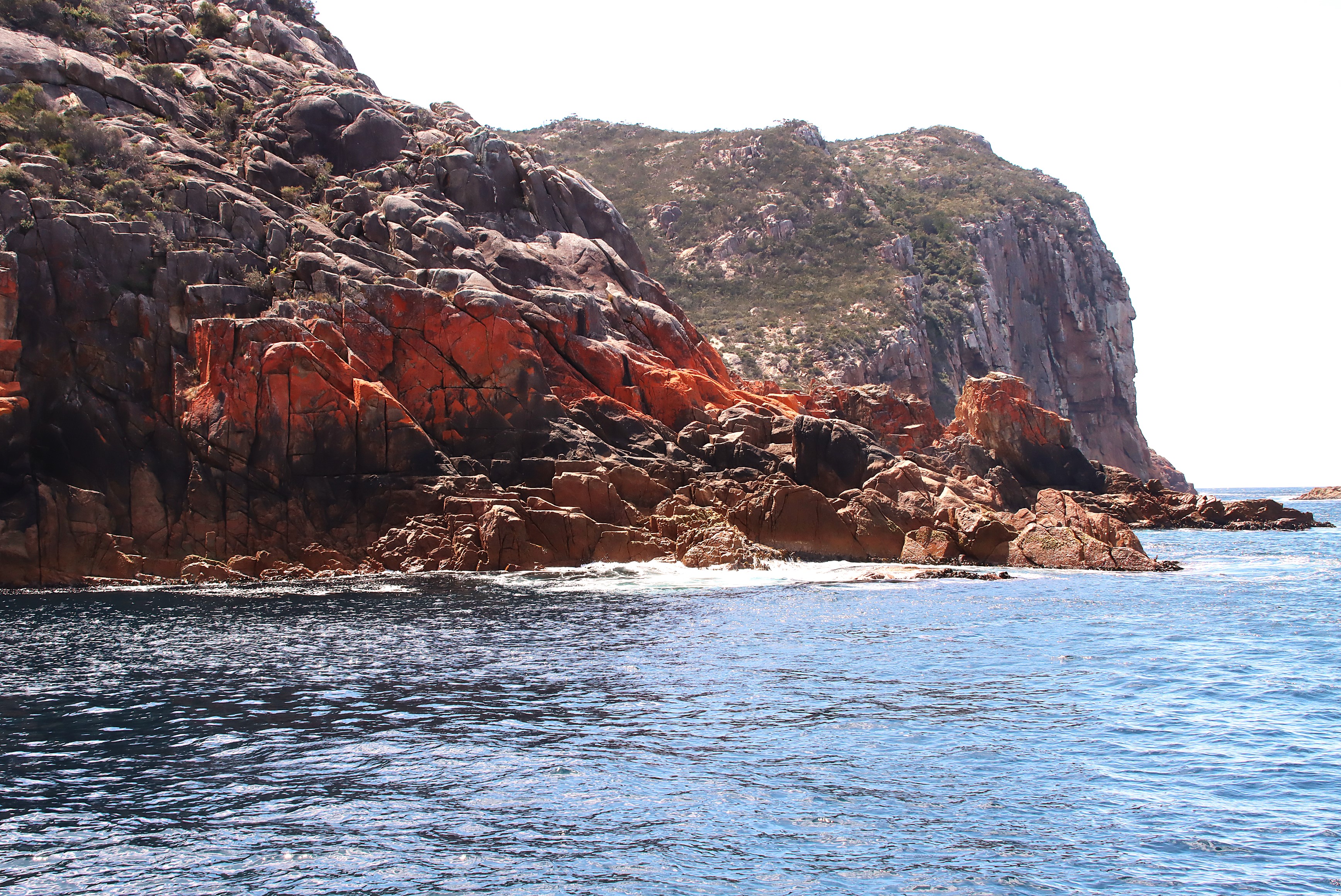
Next stop was Coles Bay, for my first Wineglass Bay cruise. The forecast was for NW winds gusting up to 100kmh, so they advised it might not be possible to go out into the Tasman Sea and get into Wineglass Bay. As luck would have it, enhanced by a fast run up the coast to beat the wind, we did make it.
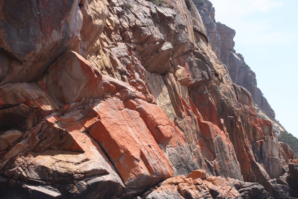
The rocks are quite different to the wonderful Tasman Island (south east corner) cruise, that area being largely the massive dolerite cliffs and more typical sandstone. Freycinet, named by Baudin, is generally volcanic pink granite. The granite runs right up into southern Victoria, presumably merged by pressure, given that Tasmania and the mainland arrived here at different times by different routes.
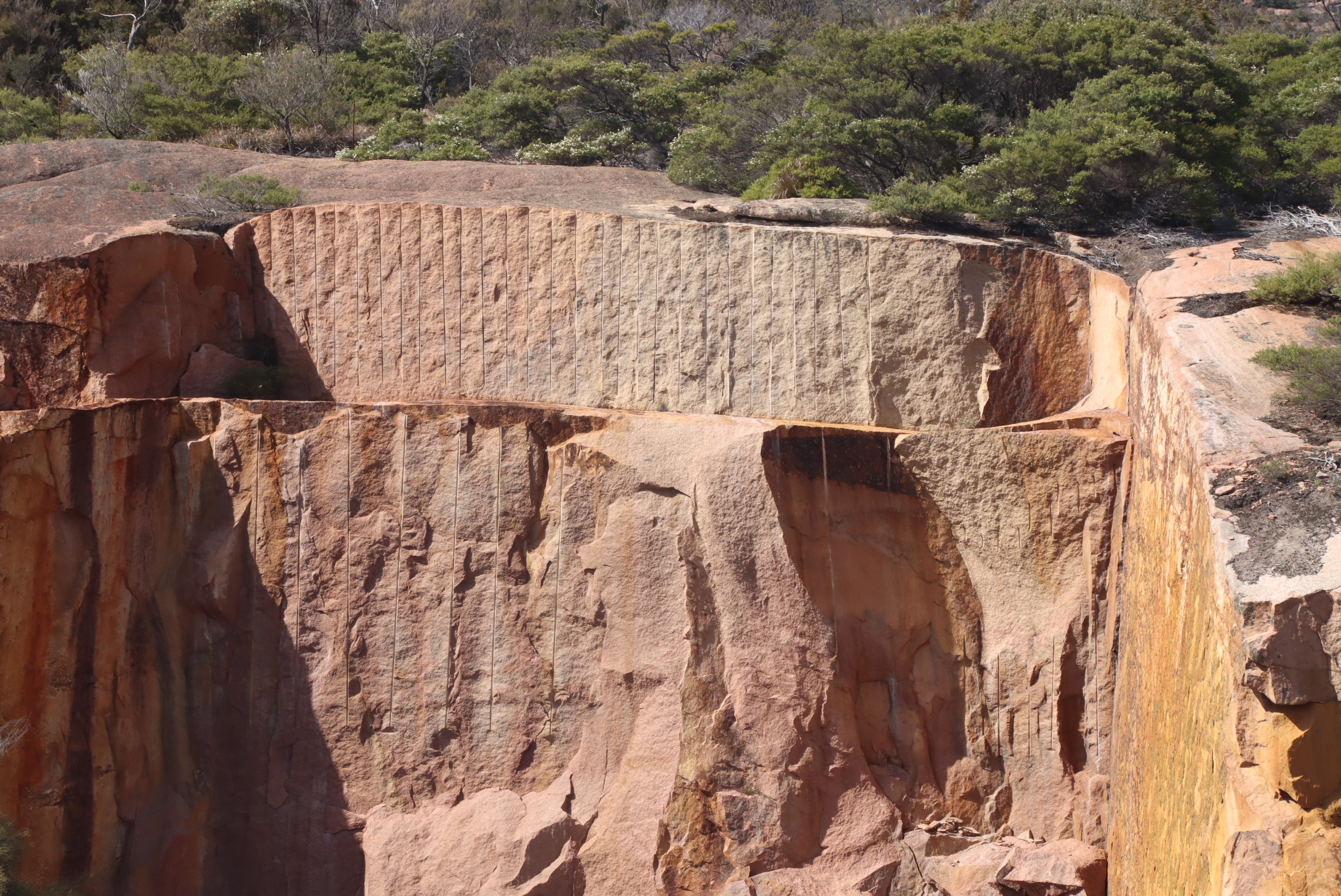
Although the granite can be found in various modern buildings, such as the new Parliament House in Canberra, many failed attempts have been made to commercially quarry here. In the earliest days, they would drill into the rock with a hand-drill, insert wet plugs and wait for the expansion to work a gap that could be used to lever blocks out – not a job for the impatient. The creation of the national park meant the end of dynamite, so the quarry sits as a reminder of failure.

Reflecting how interesting the Tasmanian coastline is pretty much wherever one is, I thought I had probably seen as much of it from the water as you can without your own Tom Thumb, and a cat called Trim (not too trim to end up on a dining table in Mauritius). The only available cruise/trip I haven’t done, I think, is the new luxury one over in Port Davey, but the done list is:
the Princess of Tasmania and Spirit ferries from Mlb and Geelong to Devonport; the ICAT fast cat from Bell Bay to Port Welshpool; the Tamar Estuary (not a river); flown low to Flinders and King Islands; the D’Entrecasteaux Channel; Maria Island pelagic; Brunie Island pelagic and southern ocean; Tasman Island south east corner; flown low over south coast to Melaleuca, boat trip up a creek without a paddle into Port Davey, and flown low out over west coast; and Macquarie Harbour, Gordon River and out through Hell’s Gates.
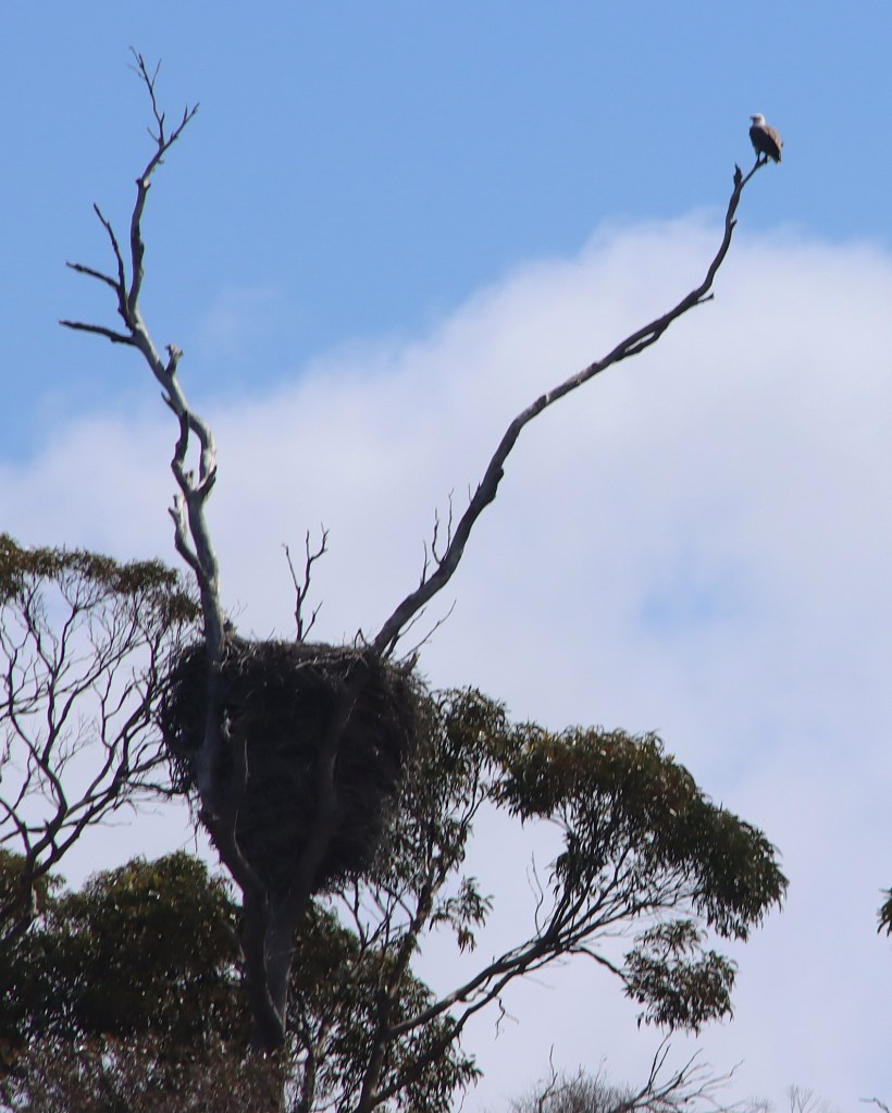
This White-Bellied Sea Eagle nest has been built over many years and is massive.
Ironically, as the Captain wisely raced up the coast, we were ahead of the wind arriving, and got closer into the rocky coastline than is usually possible. Keeping our distance as required, a couple of humpbacks entertained, accompanied by some seals and wandering albatross – the first time I had seen these birds up close.


Wineglass Bay was glorious, as it inevitably is. I recalled that the kiddies version of the name is that it is beautifully curved like half a wine glass rim. The real version is that in the whale killing days, there was so much blood sitting in the cusp of the beach, it looked like a glass of claret.


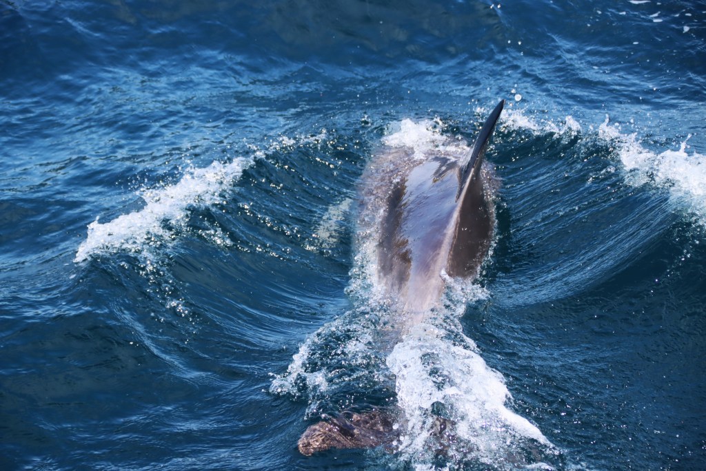
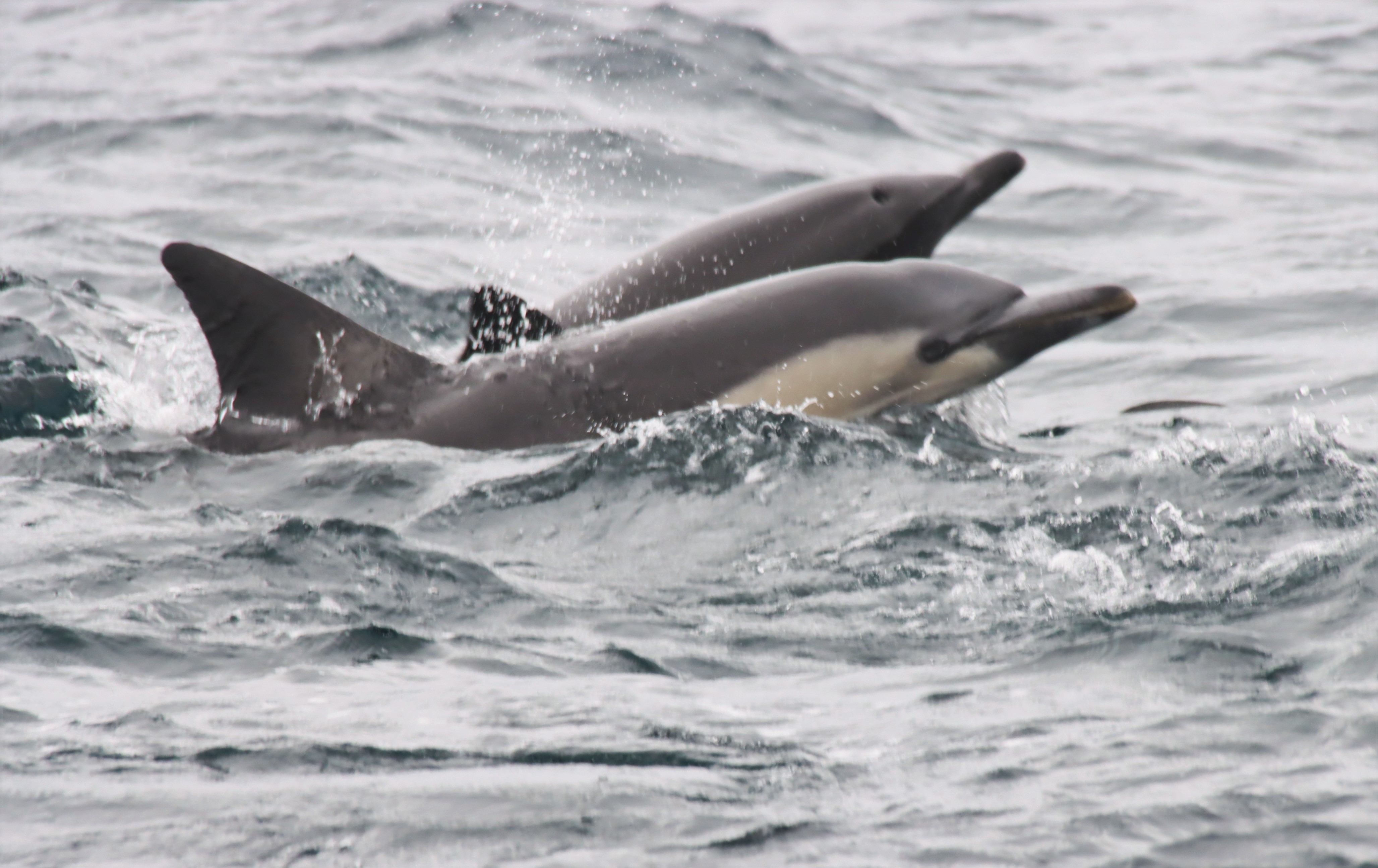
A pod of Bottlenose Dolphins was evidently expecting us, and had great fun playing in the turbulence around the boat.
Another interesting spot was one of the many ‘waterfall bay’ along this coast line, as the english again displayed their skill at innovative place names.

If Kath Day Night was on board, she would have recommended heading south toute-de-suite, as the wind picked up quickly and significantly. Made for a fast trip, being north westerly. It was really gusty by the time we got back, well except it wasn’t, compared with the rest of the afternoon. Even those like me who don’t get sea-sick were very glad not to be out on the water later on.


Michael Monaghan
Nov 2024
One thing I noticed, driving around Tasmania, was that there is definitely less roadkill. Still plenty of it, and still the most I have seen anywhere in the world, but definitely less.
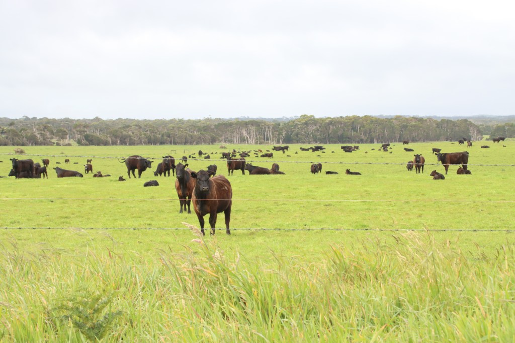
Across the State, including Flinders and King Islands, the vegetation has been cut back on both sides of most roads by about 2 metres. This apparently is designed to give the animals and the humans a better chance of seeing each other in time to avoid a collision.
In some areas they are experimenting with buzz producing transmitters which are attached to the bush side of every three or four roadposts. They are set off by the vibration of a car on the road. In effect, they are similar to those little horn looking things what you stick on your bumper bar to ward off the kangaroos, which you have to replace every five minutes when they fall off, and which may or may not work, but how would you know.
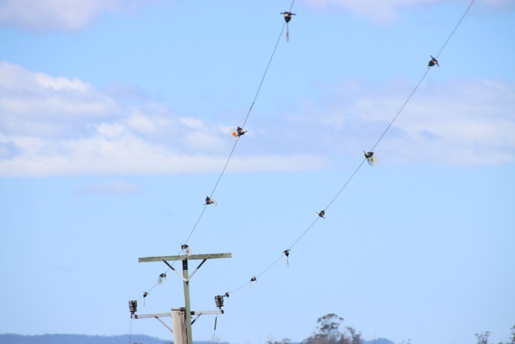
Another labour intensive exercise is to attach little spinning and light emitting thingies to power lines where there is a lot of bird activity. This is designed specially to assist larger birds of prey to miss the power lines. Each thingie is dropped over the power line by a hydro worker with a long stick. A co-worker looks down, watching for tiger snakes.
Also, I was told, in many regional areas people are encouraged to carry gloves and shovel, and, where safe, to push the road kill back off the road into the verges. Scavengers such as Tasmanian Devils and birds of prey can then devour the roadside menu offerings in much safer surroundings. It takes some time for a wedge tailed eagle to leave its meal, given they are unable to retract their claws. So they have to wriggle free of the meal, or take it with them, to avoid being road kill too.

In many places, the speed limit between dusk and dawn is 45kph. Irritating perhaps, but it seems good practice to me to just avoid driving at night time. On more major roads, there are now lots of signs warning drivers to be alert to wildlife. There seems to be a growing number of people who say the driving speeds in Tasmania are just too high for the road conditions; I am definitely one of those.
Michael Monaghan
November 2023
This is my first trip to King Island and, being a weather forecast studier, I maximised activity on the first three days. Just as well. Being close to the west coast and oblivion, the wind and rain on day 4 prevented getting outside, and into the night you did hope they knew what they were doing when they built this building.
I would say, for me, this Island is very similar to Flinders Island. Flinders on his great trip with Bass and John Franklin, named King Island after Phillip Gidley King. This trip proved there was a Strait, later named after Bass by King. On an earlier trip without Flinders, Bass, whilst discovering enough about tide flows to be sure there was a Strait, named Flinders after, well, Flinders. It turns out Flinders named none of the hundreds of landmarks he named after himself, but did name one after his fellow sailor brother. King Island and the Furneaux group were all part of one land mass with what is now Tasmania. If you go to Eddlestone Point on the east coast, you can see where the then landbridge ran over Cape Barren and Flinders Islands. It is a little known fact that there is a land border between Tasmania and Victoria, being on Border Islet. Border Islet is part of the miniscule Hogan Islands, and, at 39/12 degrees Sth, is about 56 km south of Yarram, just east of Wilson’s Promontory. The border was set apparently in the belief that the Islands were slightly north of 39 degrees.
I can, from first hand experience, confirm that we are, at about 64km, not far from the Otways in southern Victoria, as I was awoken at 230am by things rattling and the bed wobbling, effects of the earthquake centred there – turns out it was the strongest earthquake ever recorded in that region.
In just a half hour calm flight from the Burnie Airport, which to save confusion they built in Wynyard, we arrived at an efficient airport on the Island. It is about 5 minutes north of the main (only) town, Currie.

Currie is more or less mid Island west coast. The only two supermarkets/shops on the Island are next to each other. A bakery is flanked (LOL) by the King Island Butchery, selling fantastic looking meat for which the Island is famous.
The Cheese Factory is about 10 minutes north of Curry. They are only open a few hours a few days, but do sell a number of cheeses you can’t buy anywhere else, as well as many you can. The other two main enterprises are the gin distillery and a relatively new brewhouse, using very old wild hops found on a farm in the Island’s far south.

My motel’s highlight feature was the view of the west coastline, just a few hundred metres away. Was very nice sitting outside on the first three evenings, impossible on the fourth. Most of the land between me and the sea is a golf course, one of three or four. All, like this one, have coast positions. Given the winds we experienced yesterday, I reckon a good wood into the wind would see the ball returning over your head.

Pennys (sic) Lagoon is an example of a Perched Lake. Dismal Swamp in the north of the Tasmanian mainland is another, and there are several on Fraser Island in Queensland. It is rain filled, but the lake bed has been effectively sealed over the millenia by vegetation, bones, shells etc so the water doesn’t drain out. It is said to be a favourite swimming spot.


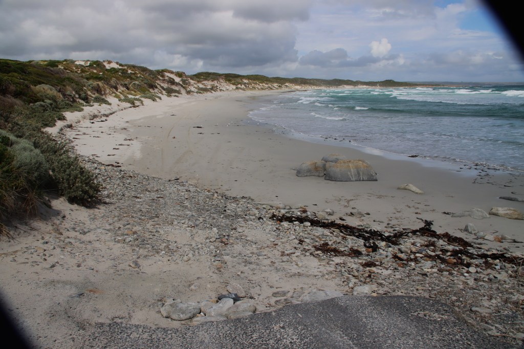
One of the nicest beaches I visited was paradoxically called Disappointment Bay. It is so named I believe because of the wreck there in 1835 of the convict ship, Neva, from Cork, with a loss of over one hundred lives.

Given its location, it is not surprising that there are many ships wrecked on the west coast in particular. For example, off this picturesque beach is the British Admiral.
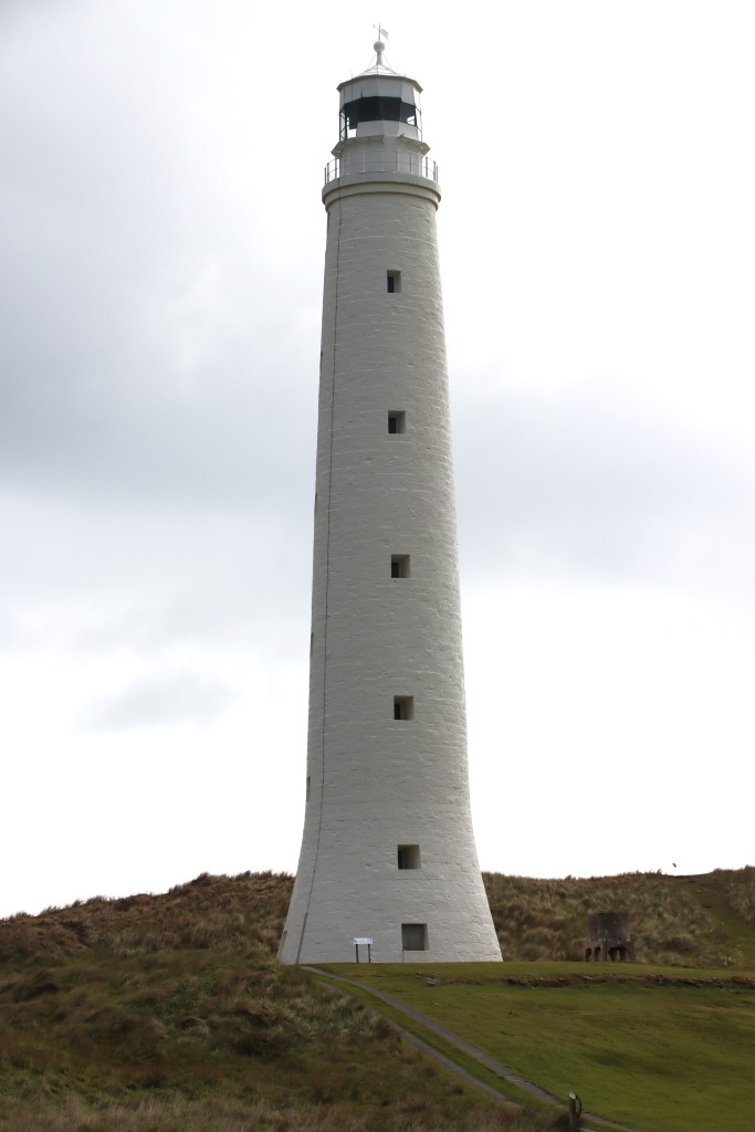
The danger to shipping gave rise to two lighthouses, although many people had to perish to sufficiently stimulate the authorities to oblige. In 1845, the Cataraqui hit the Island with a loss of 402 lives. Eventually, in 1861, the tallest lighthouse in Australia was constructed, at Cape Wickham, named after the cheese one assumes. It is 48 metres high built on a 3.4 metre platform. Each stone was hand-carved and it is a very impressive masterpiece. According to the information board, today’s residents are limited to the yearly nesting of two peregrine falcons.
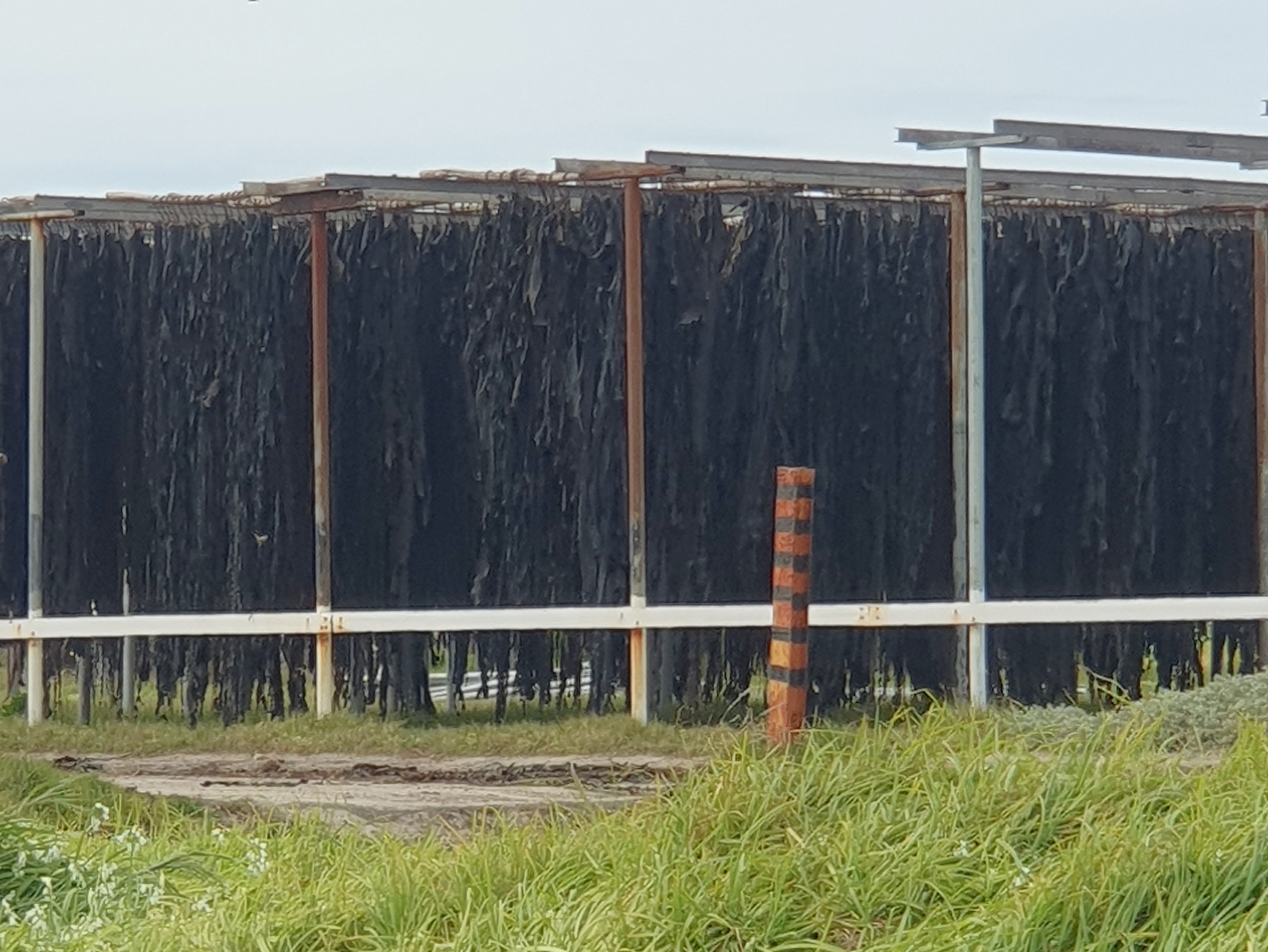
As seen on Backroads, the kelp industry is of major significance. Kelp is hauled with huge effort off some remote southern beaches, and trucked up to the factory in Currie. It is hung on large and extensive metal frames, before being treated, granulated and then shipped to Scotland and Norway. There it is turned into all sorts of consumables, including pharmaceuticals, gels, toothpaste and even salad dressings. Kelp is by all accounts very heavy stuff and hydraulic power plus brute force is required to get it on and off the trucks.

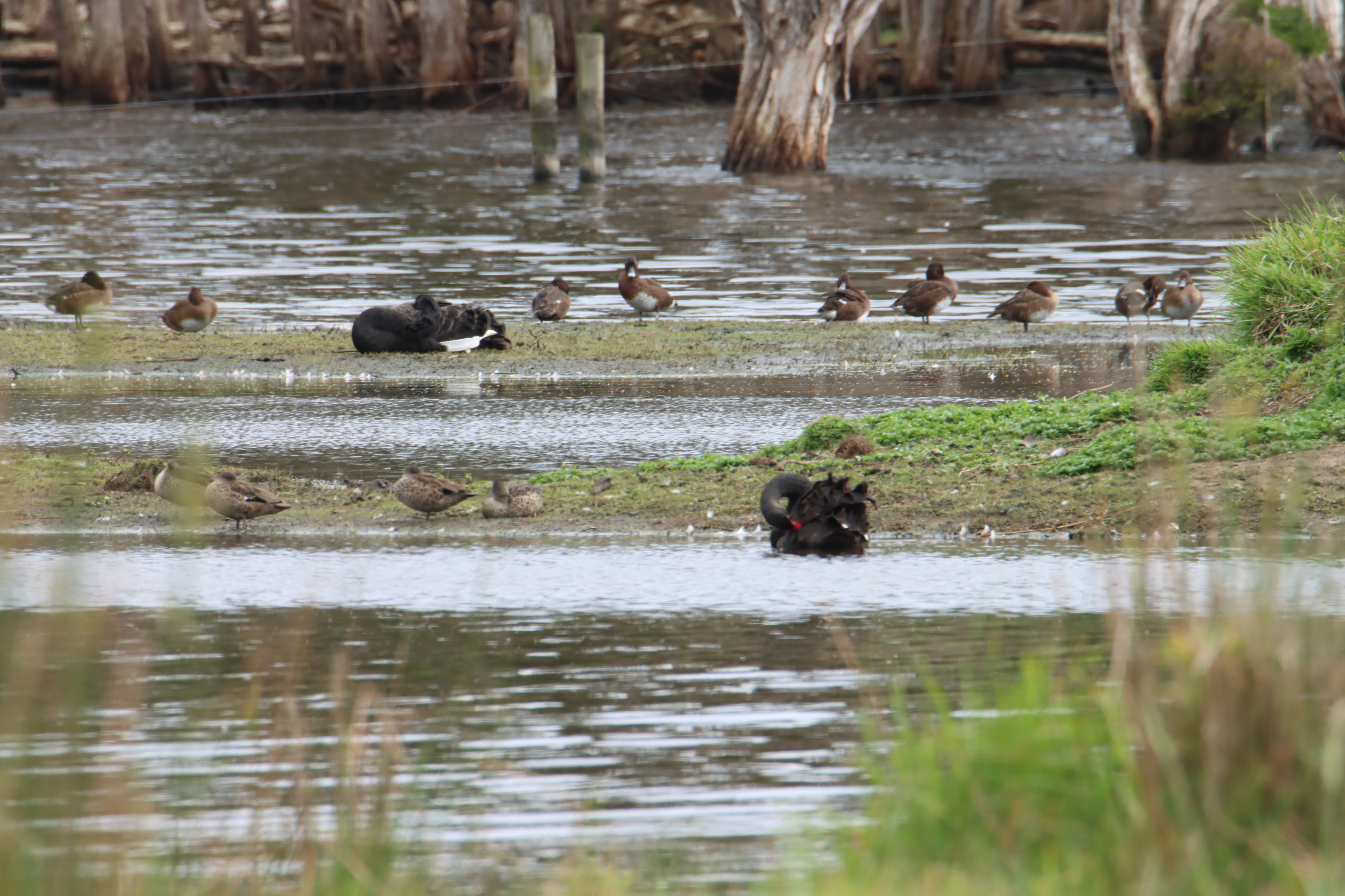
Black swans are incredibly plentiful. Shag Lagoon (no, not that, but because in the earliest days of european settlement it was heavily populated by Shags – probably on the rock). Now there are none, but it is clearly a major breeding ground for the swans, with multiple generations being visible. There were also lots of Cape Barren Geese, Blue-billed Ducks, Grebes (I think Australasian), Pacific Black Ducks, Eurasian Coots, Welcome Swallows and Shelducks. As is common across the Island, Melaleuca dominates here, being sometimes quite tall.


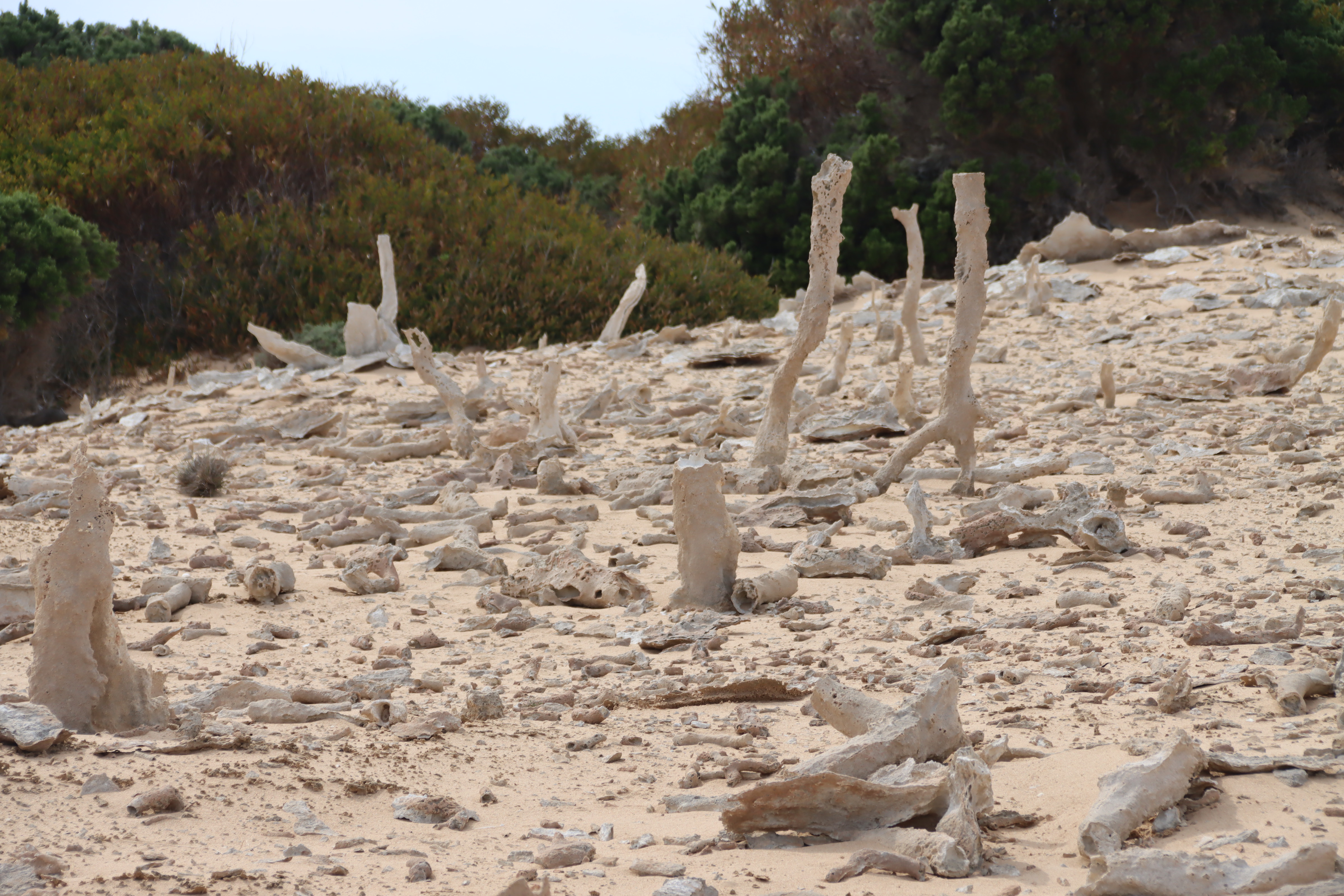
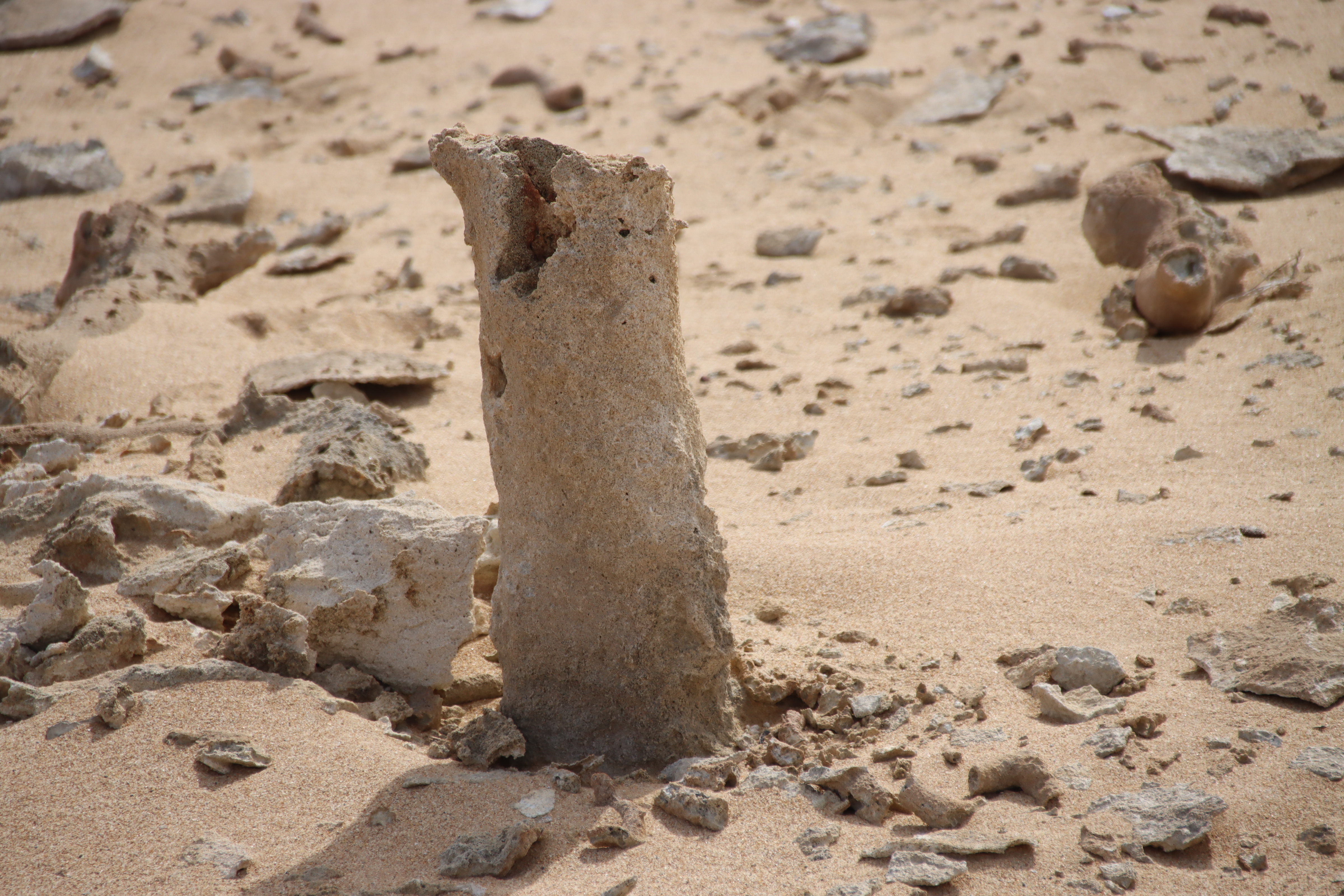
The highlight is a very interesting phenomenon is the calcified forest. Looking indeed like the remnants of a forest, it is in fact the remnants of the silica which coated the trees about 7000 years ago. The trees rotted over time, leaving the sand casing. Being windswept, you wonder how long it will last as it is.


Overall, I found the Island very neat and tidy, with the many bluestone gravel roads very well maintained and safe enough for a little corolla. The shrubbery is cut well clear of the roads even in the less travelled roads, presumably in an attempt to minimise roadkill. There is plenty of that, mostly Bennett’s Wallabies, but nowhere near the appalling volume on mainland Tasmania.
Michael Monaghan
October 2023
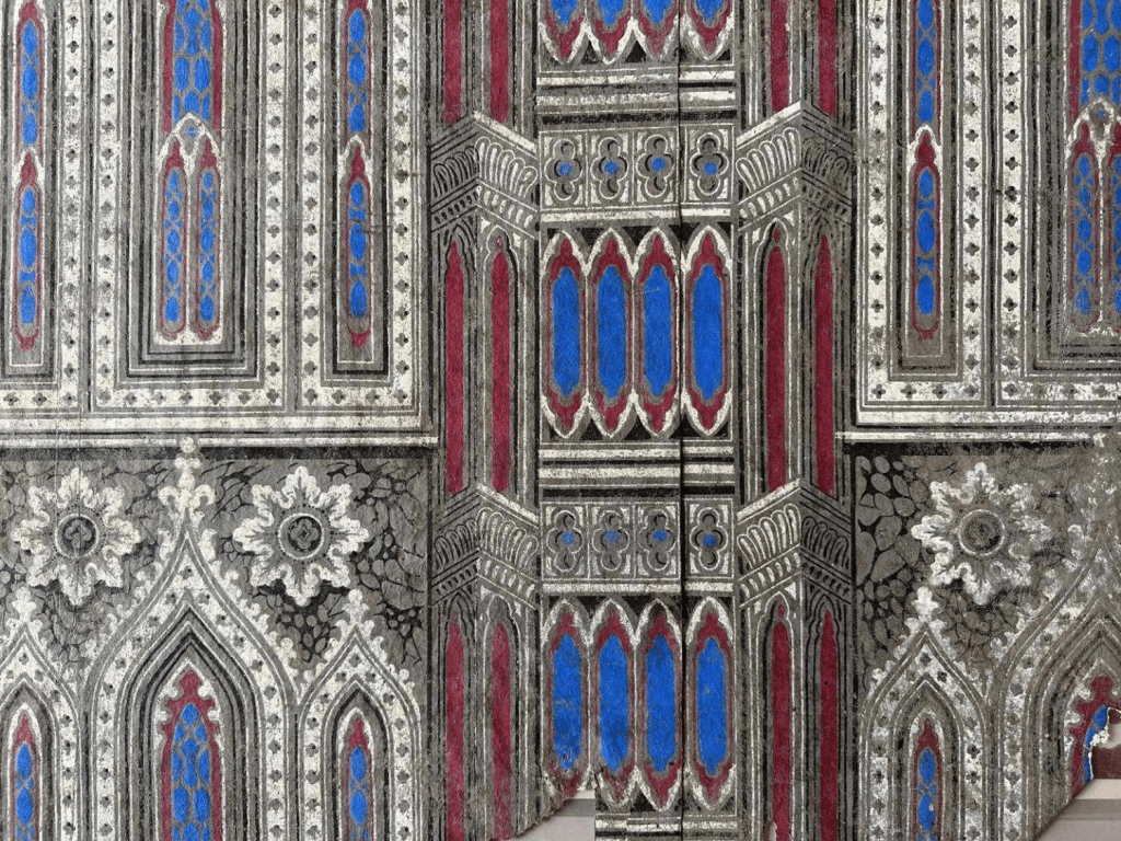
Source: Alan Townshend presentation
I went to a fascinating talk by renowned wallpaper expert Alan Townshend, one of many interesting talks held by the Tasmanian Historical Research Association. Alan’s presentation dealt with early Tasmanian (Van Diemen’s Land) wallpaper, and associated frippery.
It wasn’t long after the free settlers, led by David Collins, and accompanied by enough convicts to build a future, arrived on the Ocean into the fledgling “don’t you dare come here you naughty french types” occupation by Lt Bowen at Risdon Cove, that opportunities for massive profits were apparent.
If you read my account of my great great great great great uncle, William Collins, substantial remnants of whose 1804 shop still exist under the Bank Arcade, you would have seen that way back then he had the wealth to pretty up an otherwise stark set of sandstone blocks.

Source: Michael Monaghan
Collins arrived intent on a fortune from whaling, establishing a whaling station on Droughty Point, very close to the land later granted to my first fleet ancestor, Andrew Goodwin. Others, like John Ingle, were astute enough to see that the settlers would want supplies, which he would obligingly provide at a suitable margin. Harris and Hopley served their respective roles as surveyor and surgeon, gaining the grants and free labour their public service demanded.
All these men married daughters of the remarkable Jane Hobbs (nee Maine), an American who married in New York an English Commodore, William Hobbs. Being a Commodore, Hobbs was well connected. After he died after a fall on his ship, the English heirarchy saw the benefits of four free english girls accompanying the gentlemen on the Calcutta. True love (arguably of wealth) inevitably followed. The next generation of the family (Gunning, Kearney, Burn) ended up with huge swathes of grazing land stretching from north of Hamilton to near Triabunna. They were also significant players in the establishment of Richmond.
Hopley had already married my direct ancestor, Judith, in England, and sponsored Jane and her children out on the Calcutta, first to the unsuccessful attempt to settle in Port Phillip, then by the Ocean to the first permanent European settlement in Van Diemen’s Land. Jane’s son, James, became a successful explorer and married Sarah Hone, the daughter of the early Hobart Town legal doyen, Joseph Hone. He was also besties with the son of Lt Governor David Collins, and built the extant Nugent on the White Kangaroo Road east of Campania, and adjacent to Gunning’s Weston Villa (now the site of Campania House).
Word of the commercial opportunities spread like covid19, and as the traders returned to the mother country to load up with necessities like wallpaper, alcohol, waterford vases, cravates, french frocks and ceylonese spices, other traders thought they better hop on board to serve the interests of the new colony, also at, by now, a rather larger suitable margin.
A later long time owner of the Bank Arcade, Whitesides (from 1849-1922), turned it in to a european style emporium, with glass ceiling over the central arcade and large glass fronted shops.

Whitesides Arcade.c1881 by Alfred Winter from the Album of Photographs of Tas by RC Poulter, sourced from Short: A different view of Hobart p49
An early arrival, hitching a ride with the boy’s own annual Capt Jeffrey on the Kangaroo, was Capt William Bunster, who found love, or company at least, with Lucy Goodwin, the Norfolk Island daughter of my two first fleet ancestors, Andrew Goodwin and Lydia Munro. Bunster was a low key operative, but by the mid twenties was the owner of four large warehouses on the old Hunter Street wharf (remnants remain behind the later Henry Jones IXL facade) and an emporium in Elizabeth Street (opposite where the Cat and Fiddle Arcade is now), a premises big enough to hold official events and dances. By the mid 1830s he owned a large two storey dwelling at 33 (still there but now numbered as 55) Campbell Street, and the sprawling mansions of Trefusis, on the Tooms Lake Road, again still existing and still as a thriving merino business.

Bunster warehouses are 1,3,4 and 5 from the left. The right photo is his house now numbered 55 Campbell Street, Hobart.
Bunster’s ads for his Emporium were certainly as frippery-full as those referred to by Townshend in his talk.
Now to the wallpaper.
Townshend, through decades of research, tells all sorts of amazing tales of the earliest days of European Tasmania. Within a few hundred metres of the squalor of Wapping, most vividly depicted by the countless reports of the Hobart Rivulet providing a repository for dead bodies of humans and animals, raw sewerage, and (eerk) drinking water, the “upper” class paraded in their english, french, and ceylonese finery. Once home, invariably in the higher links of Sandy Bay, North Hobart and New Town, they probably barely noticed the thousands of pounds worth of the most expensive wallpaper money could buy. The sketches and later the photographs show the splendour of the clothing and furnishings that arrived regularly from back home.

Source: Alan Townshend presentation
An amazing story is the role of wallpaper in solving mysteries of history. Over in Cape Town, South Africa, one Henry Wylde, a former official from Port Jackson, was in charge of closing down the legal aspects of the slave trade. The slavers employed the time honoured tactic of spreading scurroulous falsehoods about him, a particularly pernicious aspect being that he had made his own daughter pregnant. The facts that his wife had chosen to remain in London, and he had recently been on a vacation with his daughter, were grist to the mill. Eventually a Royal Commission totally exonerated the pair of any naughtiness.
In the meantime, a young James Booth was charged with closing down the maritime aspects of the slave trade. The two parties met through the course of business, with James then marrying Wylde’s daughter. They then disappeared from history for some years. Hold that thought.
Whilst renovating Oak Lodge, a very early Richmond, Tasmania, residence, Townshend noticed that the wallpaper was a twin of wallpaper he had seen in the Commandant’s House at Port Arthur. The Commandant for many years was one Charles O’Hara Booth.
Ready to make the link?
Deeper exploration revealed that James Booth was the brother of Charles O’Hara Booth, and that James was the owner of Oak Lodge, when his brother was at Port Arthur.
So the mystery of the disappearance of James and his wife from Cape Town was solved not by elementary deduction, dear Watson, but by wallpaper.
Acknowledgements: Alan Townshend, Noel Frankham, John Short
Michael Monaghan
May 2023
Picture this: 7 metre swell; Sydney to Hobart yachts slicing through; Pennicott Tour boat passengers soaked in the spray; Ginger tablets inadequate. Those amongst you who have sailed the Sydney to Hobart will know this neck of the ocean well, with, for want of a better expression, all its ups and downs.
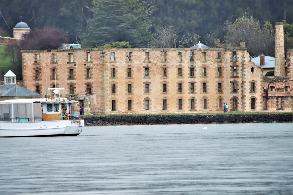
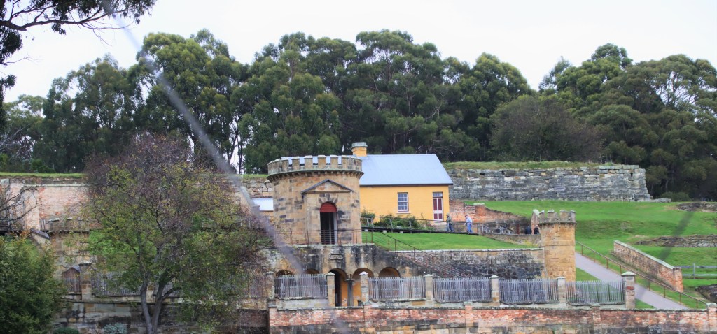
Luckily, the day of my trip was “relatively” calm, so was lucky enough to score the whole one-way trip, from Port Arthur up to Pirates Bay.
Port Arthur looks relatively benign from the water. Very few of the original buildings survive. The yellow cottage was built for the Young Irelanders rebel, William Smith O’Brien (his story is a must read before you go to Port Arthur or Maria Island – or Tassie really). The commandants house has a remarkable story, in that the wallpaper is the twin of that in Oak Lodge, Richmond. (Booth was commandant, and his brother, Booth, lived contemporaneously at Oak Lodge, a discovery made by Alan Townshend from examining the wallpaper.)

These are Common Dolphins, ie not the Bottle-nosed Dolphins we might be more used to.
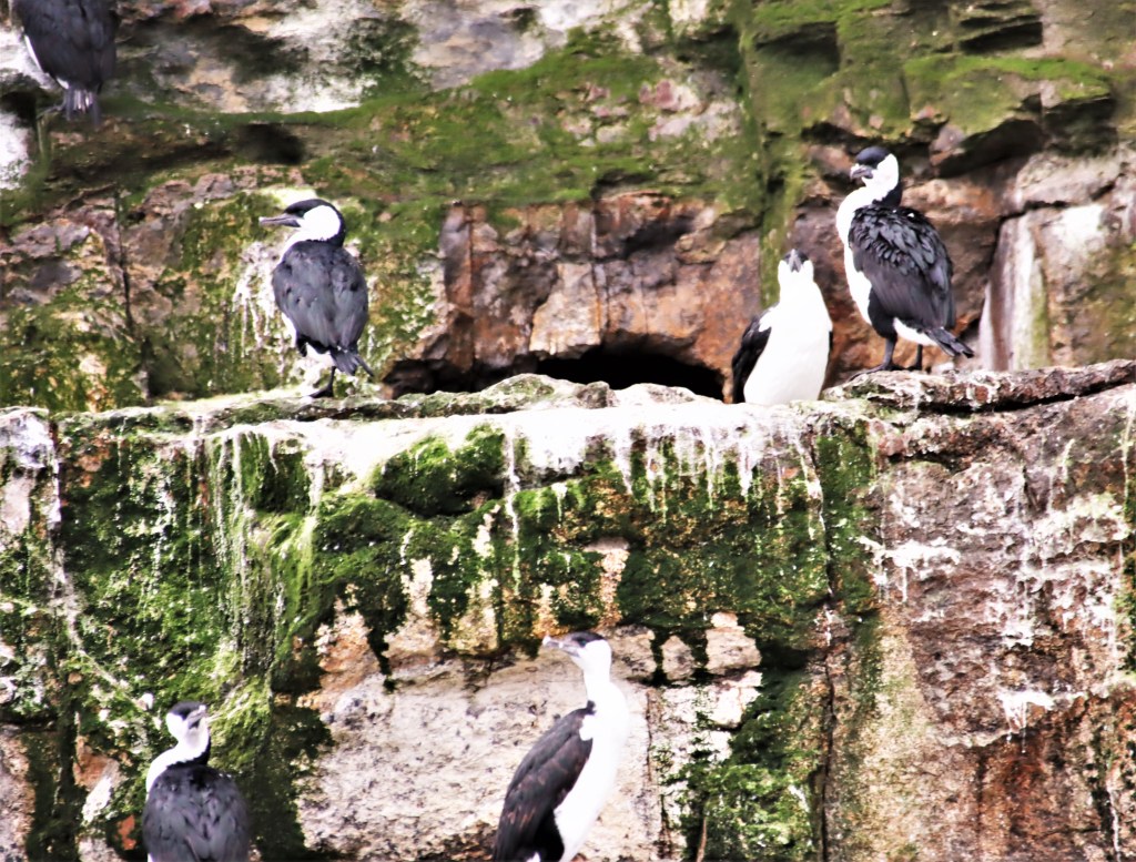
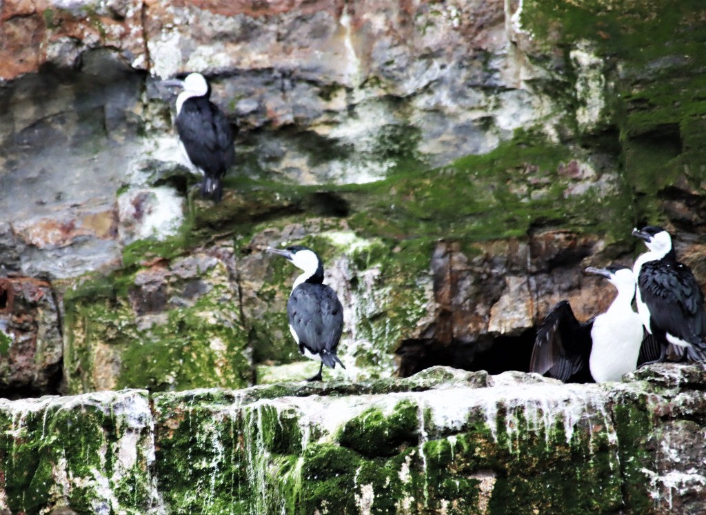
Found only on the southern most shores of Australia, and the first time I have seen them, are the Black-faced Cormorants, locally known to all dads as long-necked penguins. Also spotted, but epitonymously not photographed, were a couple of Shy Albatross.

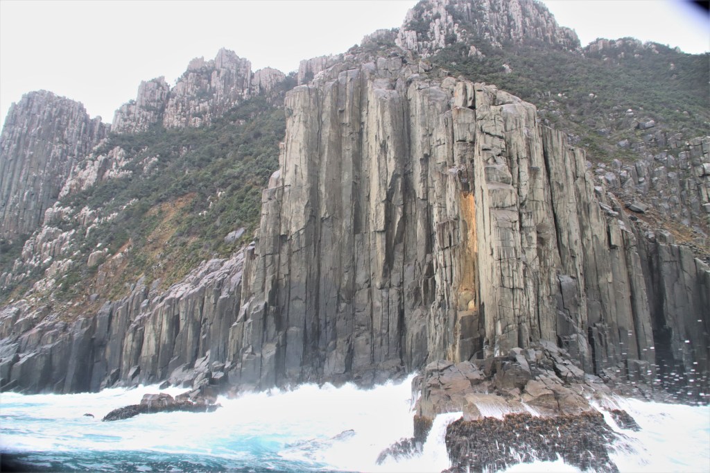
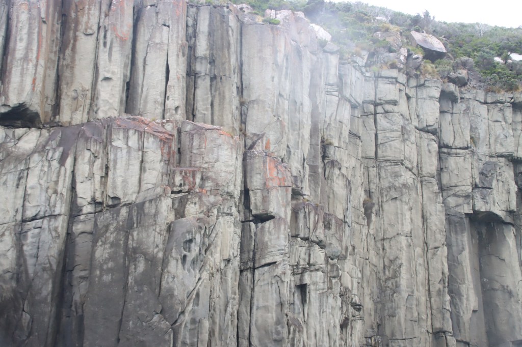
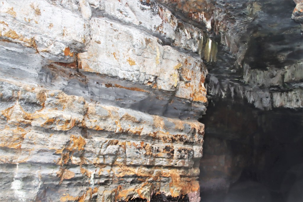
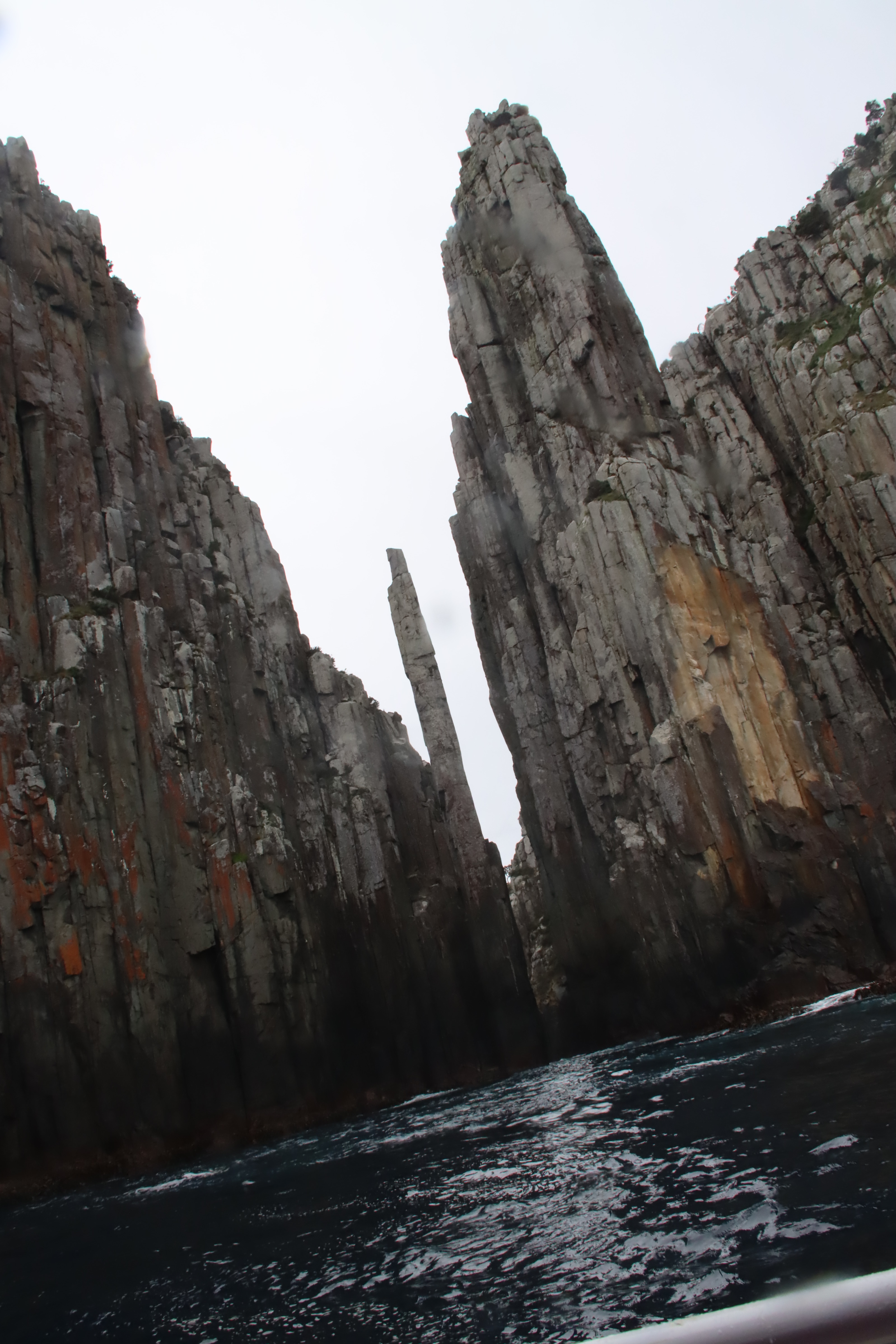
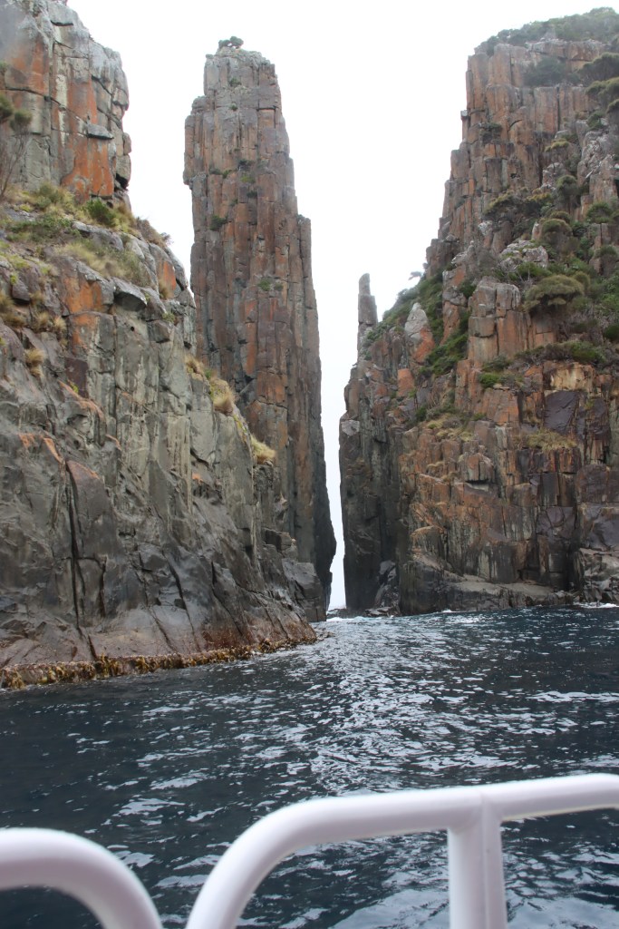
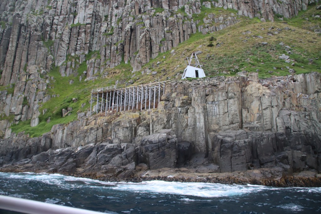
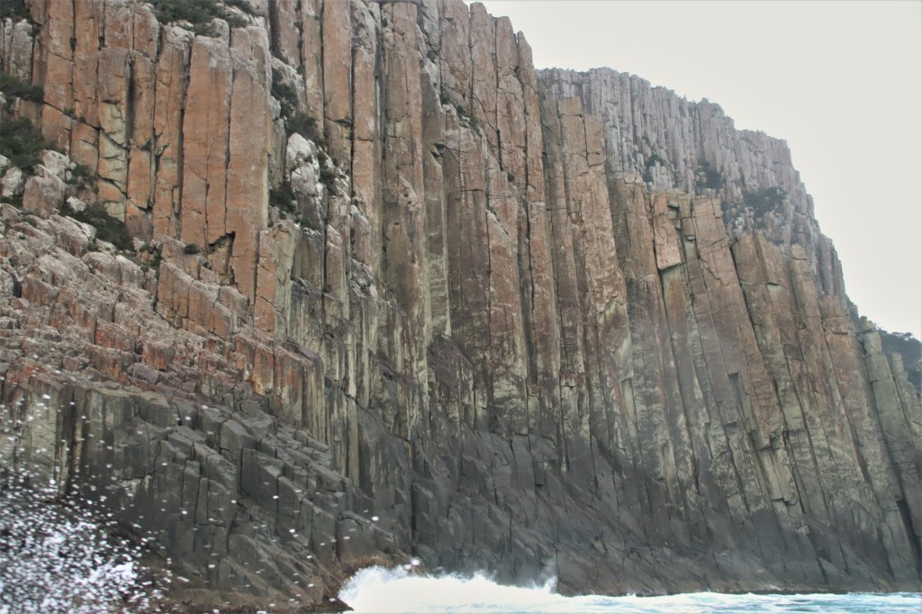
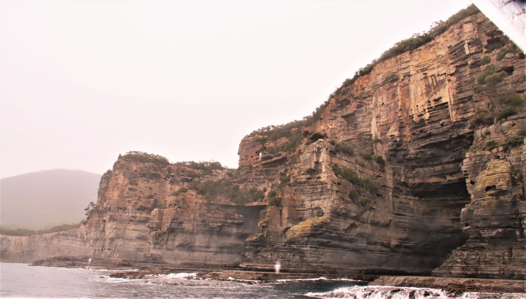
The rocks on the western side are classic Dolerite cliffs, with the tell tale columns, at some 300 metres said to be the tallest sea-cliffs in the southern hemisphere.
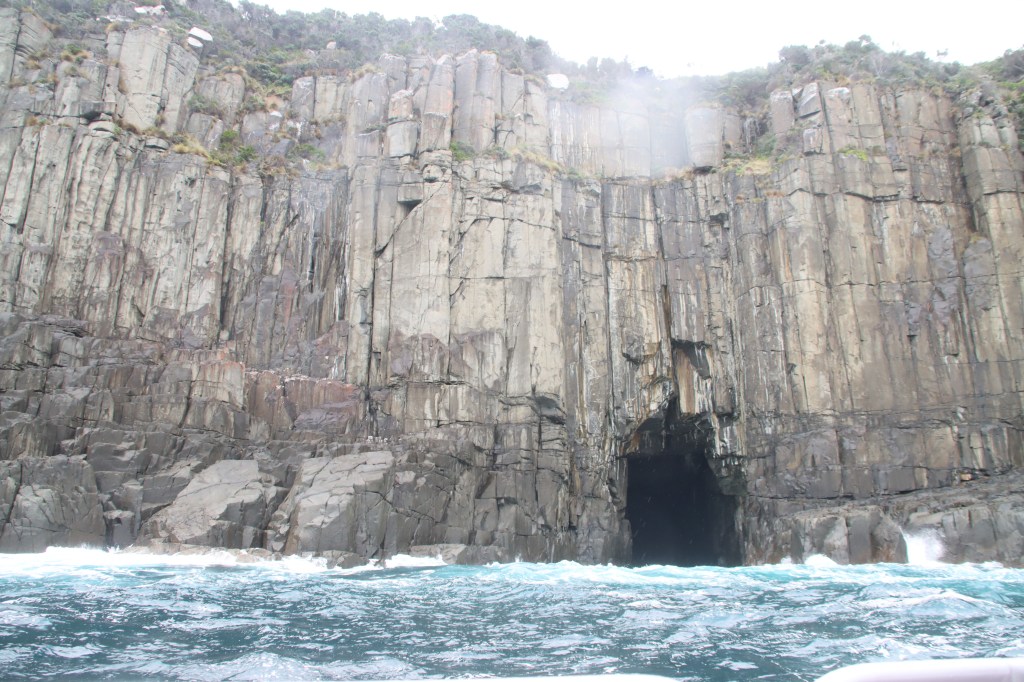


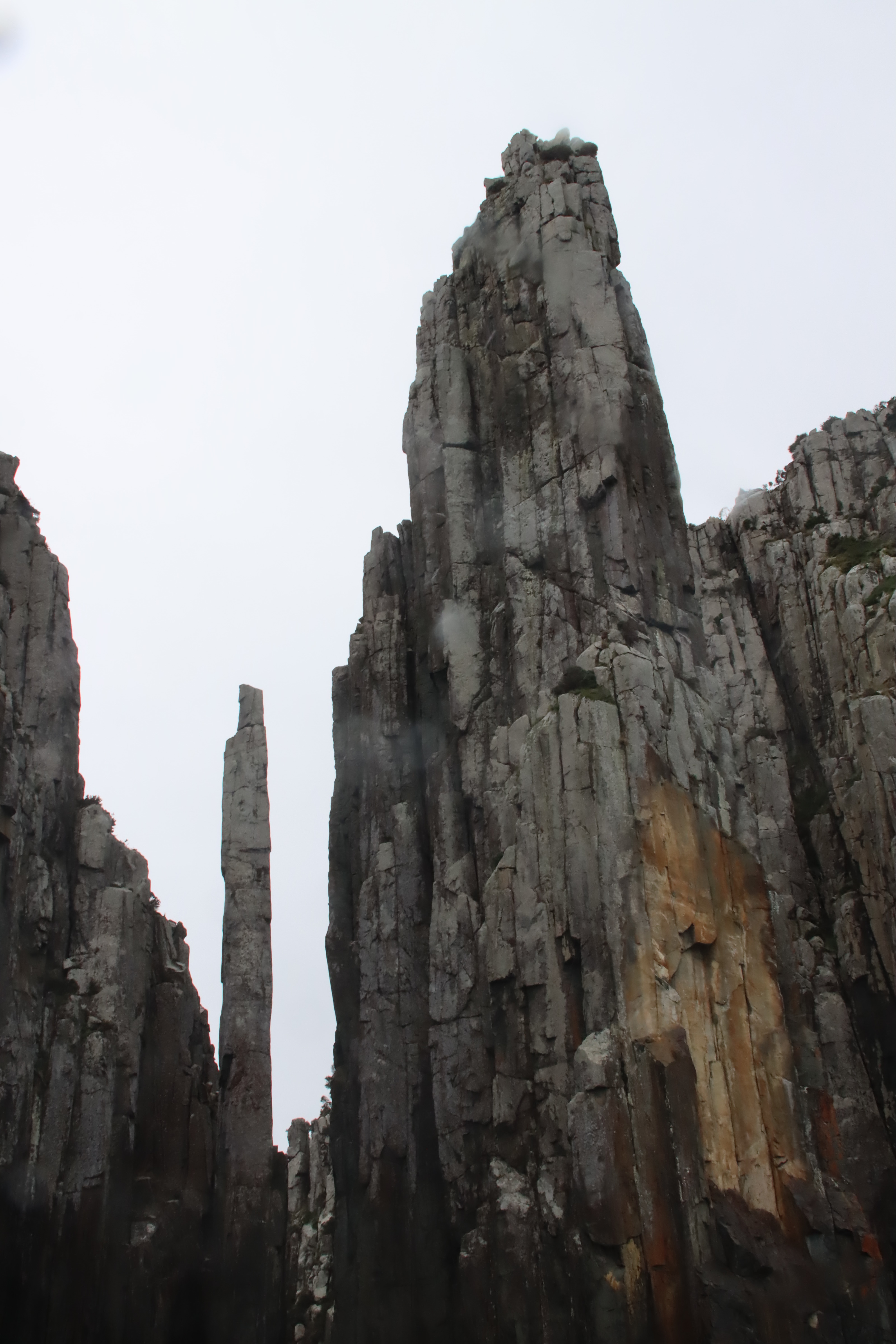
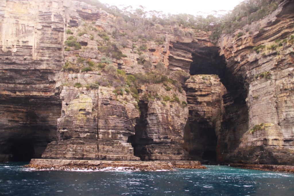
Further round we found the famous crag and totem pole. Otherwise apparently sensible people climb down the crag, and then rope across to the top of the totem pole which they then descend so they can get closer to the raging angry waters. The only way off from there is to hope someone thought to bring a boat.


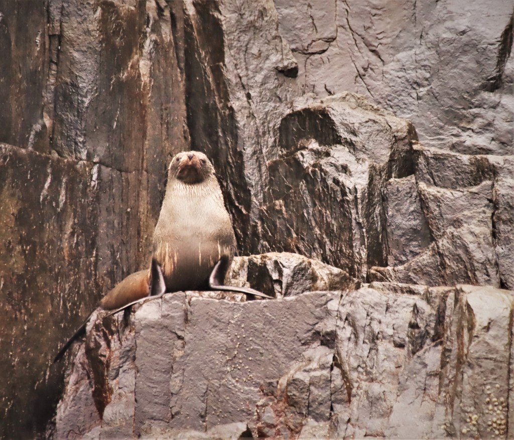
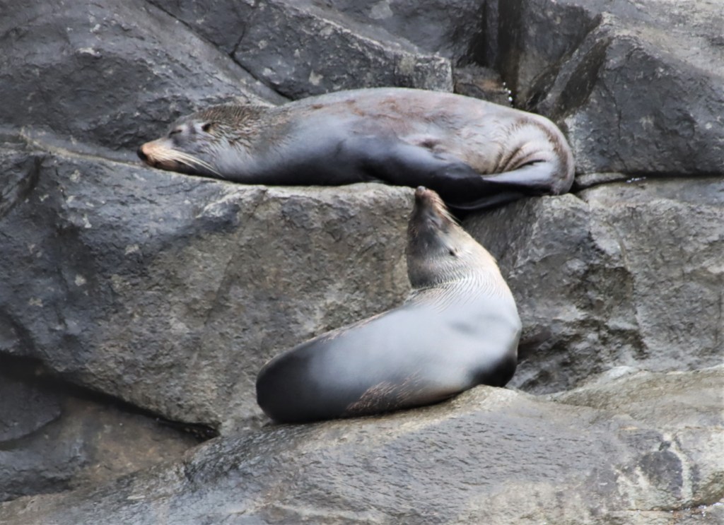
The seals are (first two) Long Nosed Seals, males only, and then the ubiquitous Australian fur seals, both sexes.

Tasman Island is the cornerstone, and spectacular. In the good old days, the lighthouse keeper and family had to ascend the steep cliff face on a hawser. In a good wind, the door was often unopenable.


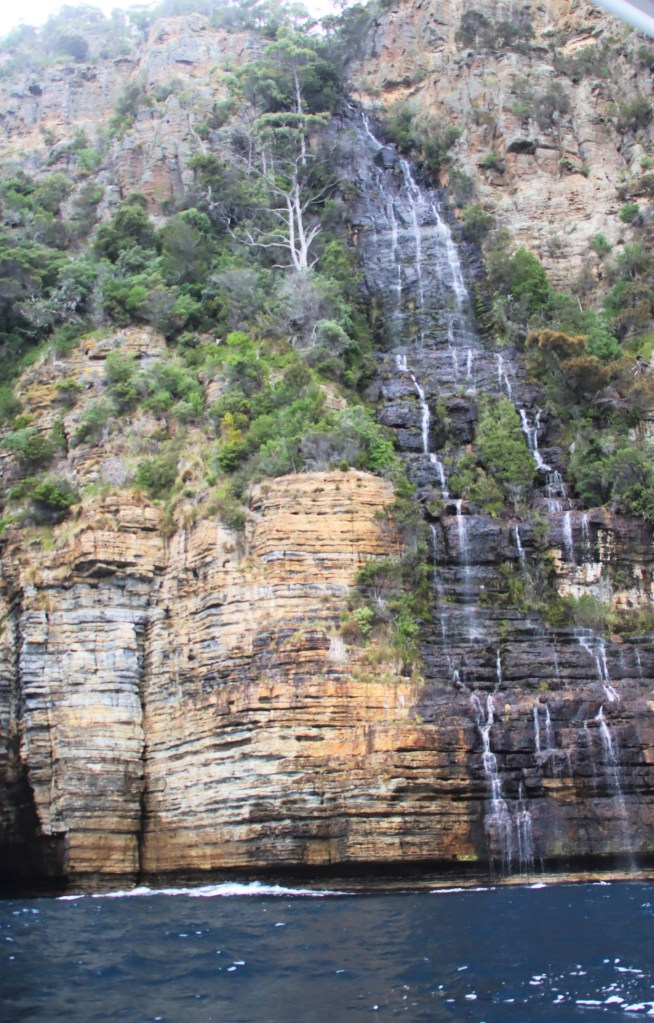
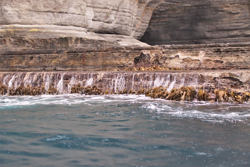
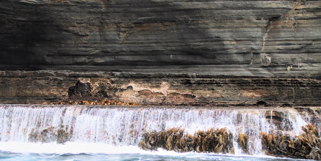
Heading further north to Pirates Bay we passed Waterfall Bay, the feature of which was, surprise surprise, a massive waterfall.
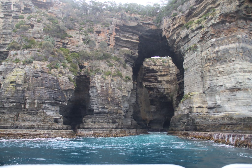
The final view was underneath Tasman Arch and the blowhole up at Pirates Bay. Being Sandstone rather than the harder Dolerite, one day reasonably soon, as is the nearing fate of the Twelve Apostles at Port Cambell (Vic), it won’t be here.
A great trip, and well worth the gift voucher which my very generous hosts gave me towards its purchase.
Michael Monaghan
May 2023
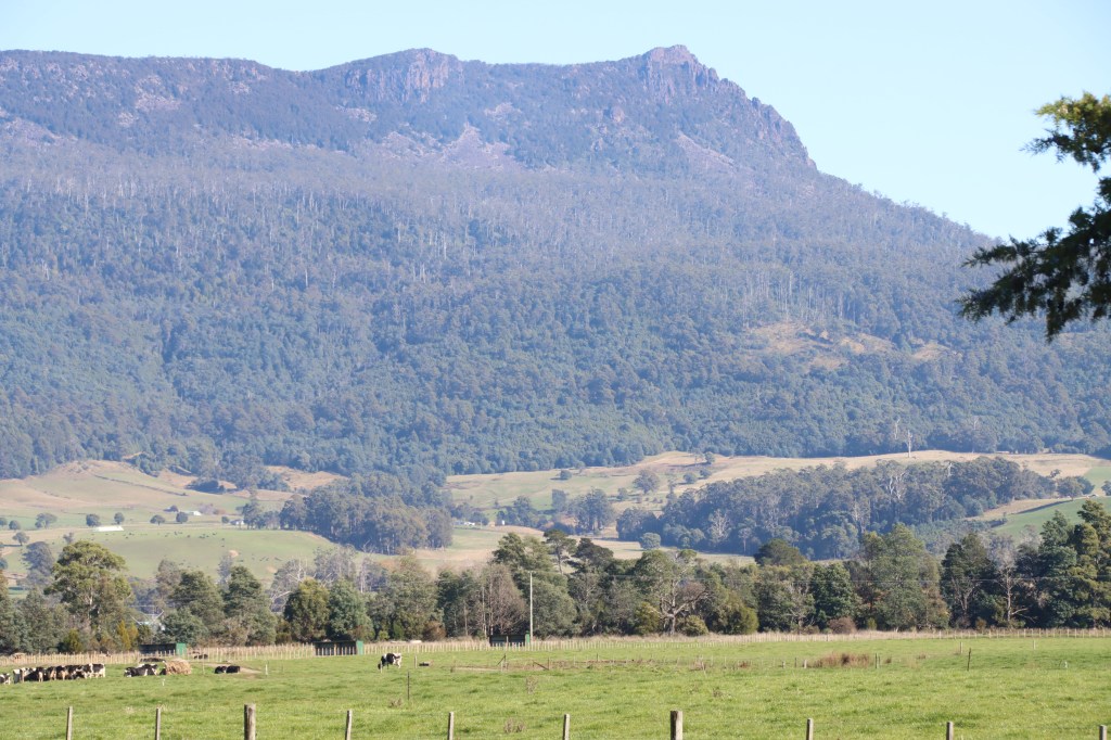
Nestled along the north rim of the Great Western Tiers, Tasmania, the Meander Valley is a highly scenic, productive and remote part of northern Tasmania. If there were any Tasmanian Tigers about, some speculate that they could well be in the southern fringes of this valley.
The Great Western Tiers (known to the indigenous people as “Mountains of the Spirits”) run more or less from Dry’s Bluff to Cradle Mountain, including a number of Bluffs such as Quamby’s and Bastian’s, and other peaks such as Ironstone, Devil’s Gullet, Dog’s Head, Mt Roland and Mother Cummings Peak.
Armed with emergency supplies of chocolate coated raspberries – truly the best tasting food ever created – from the Christmas Hills Raspberry Farm, just north of Deloraine, we headed deep into the wilds of the Valley.

First stop was at 41South, a salmon smokehouse (hot smoked) where I bought for the next leg of my journey, well, a smoked salmon.

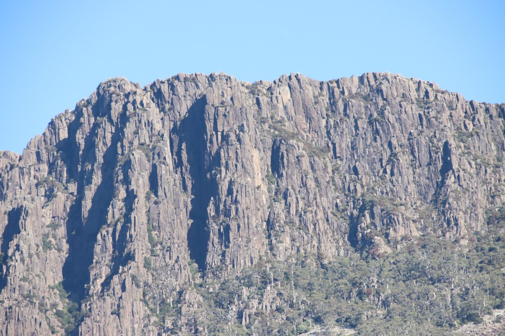
A perfect day for it – about 18 degrees, absolutely cloudless, no wind – and the tiers glowed accordingly.


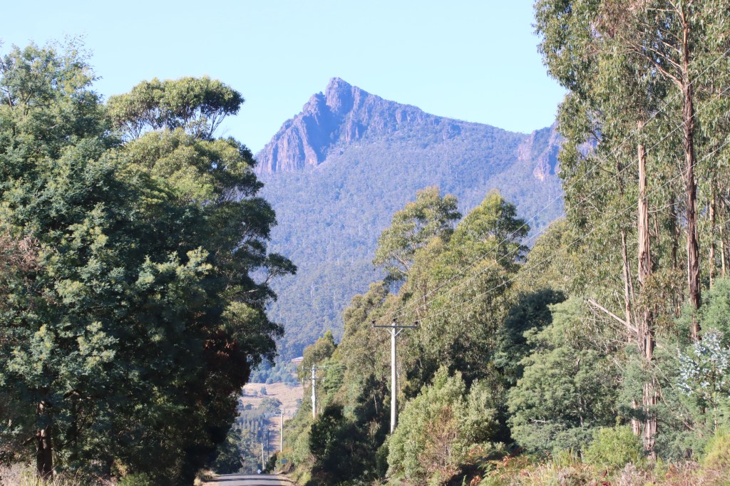
This last one is Mother Cumming’s Peak
A number of magnificent looking houses adorned the high points of a number of peaks, defying the no doubt extraordinary site costs. There are a growing number of such luxury appointments available for holiday makers, those seeking solitude, bush and narrow winding gravel roads.
Past Meander we spied (spidered?) Lake Huntsman, the Meander River dammed, and enjoyed our lunch on its shores.


Further up the forest was closed so they could shoot the prolific feral deer from the air.

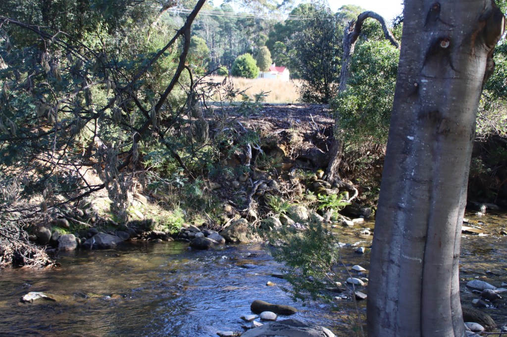
Heading back on the Lake Highway down to Liffey, we came across Bob Brown’s gift to the State, a sensational public nature reserve sitting right under Dry’s Bluff, lined by the rock laden Liffey River. A major highlight of our tour.


Taking the shortcut gravel track down past the road into Liffey Falls, into Bracknell and the like, it only remained for afternoon tea at the ever open JJs in Longford. I hope someone offers to wash my car – they did!
Michael Monaghan
May 2023
